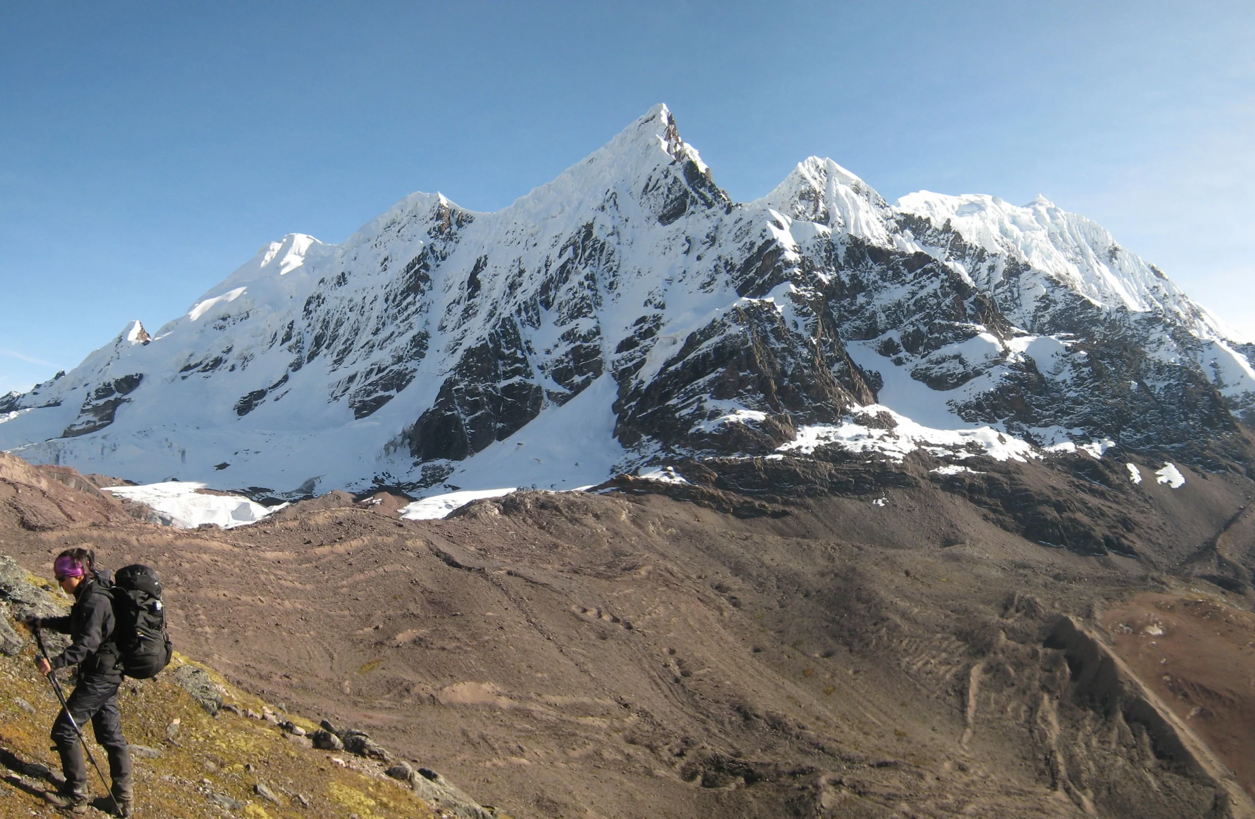
Around the world, Peru is a country of breathtaking landscapes, where the Andes mountain range cuts across its territory, leaving behind snow-capped mountains in Cusco with majestic peaks that touch the sky and valleys that are a dream for many. These snow-covered mountains are not only challenges for mountaineers and natural treasures, but also spiritual guardians for the Andean cultures, who consider them sacred “Apus,” the millennial protectors of the Andean world. That is why, together with Kantu Peru Tours, we invite you to get to know the tallest and most important snow-capped mountains in Cusco and other mountain ranges in Peru.
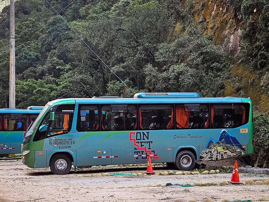
A family in the Salkantay Treking to Machu Picchu
What is a snow-capped mountain?
A snow-capped mountain is a mountain that is permanently covered with snow and ice, usually located in high-altitude areas, such as the Andes mountain range, which branches into three main ranges in the country. In Peru, snow-capped mountains are important not only for their natural beauty, but also because they are sources of fresh water, as their melting snow feeds rivers and lakes. Moreover, many of them have a sacred meaning in the Andean worldview.
What are Apus in Perú?
Apus are mountain spirits or deities in the Andean worldview and are considered protectors of communities, providers of life and energy, and mediators between the human world and the spiritual world. Apus have been venerated since ancient times, and many people in the Andes offer them tributes and ceremonies to ask for well-being, good harvests, and protection.
Hombre andino en los nevados peruanos
What is the relationship between Apus and snow-capped mountains?
In Cusco, many snow-capped mountains are considered Apus due to their imposing presence and their importance in the lives of communities. For example, the Apu Ausangate (the Ausangate snow-capped mountain) is one of the most sacred in the region and is believed to have great spiritual power. During the Qoyllur Rit’i, an Andean festival, pilgrims climb the glaciers to honor these Apus and perform rituals. Thus, snow-capped mountains are not only sources of water and landscapes, but also pillars of the cultural and religious identity of Cusco.
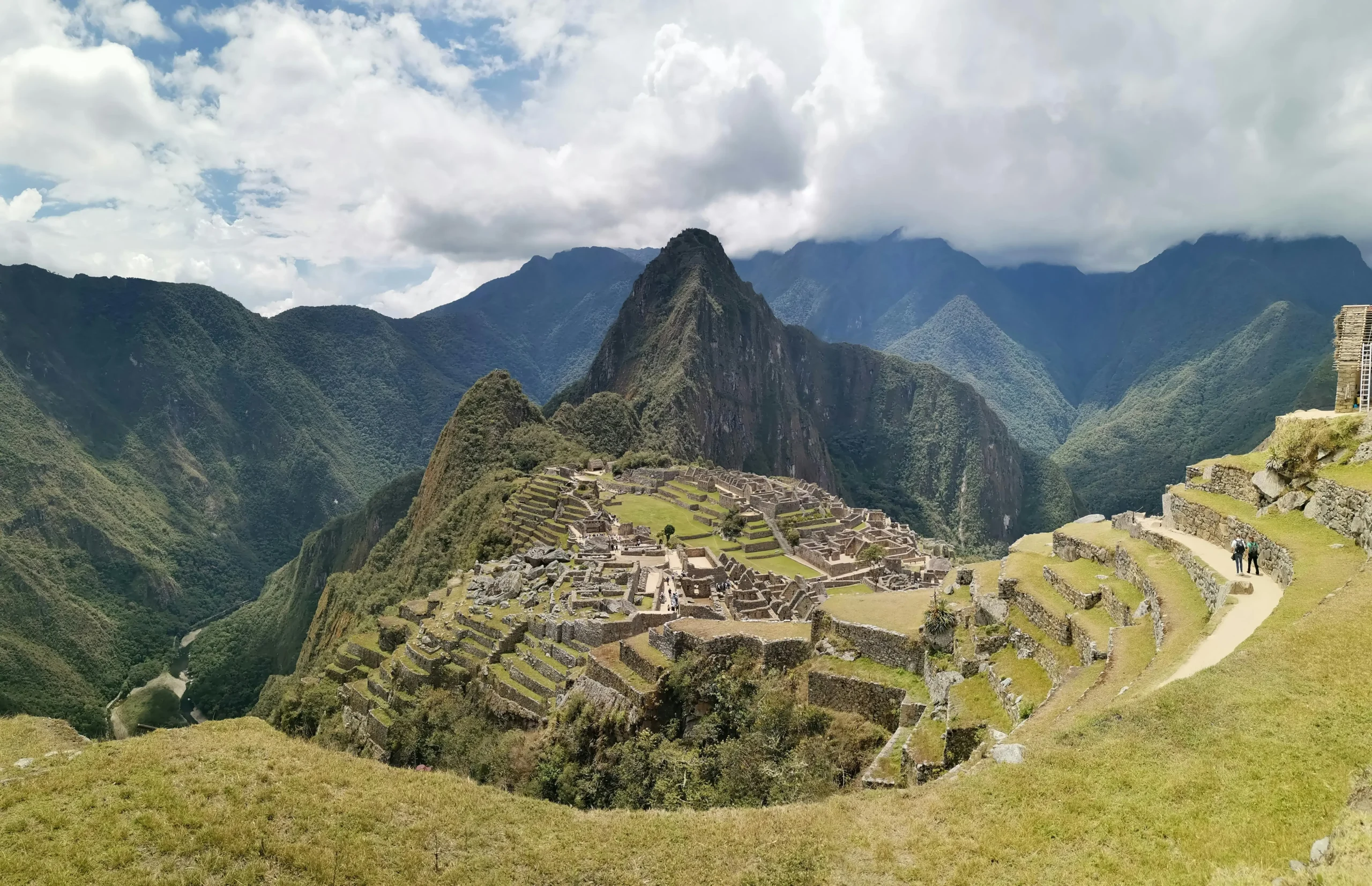
Snow-Capped Mountains in Cusco of the Vilcanota Range
Ausangate Snow-Capped Mountain
The Ausangate is the tallest snow-capped mountain in the Cusco region and one of the most revered. In addition to being considered a protective Apu, it is the center of the Qoyllur Rit’i pilgrimage, one of the most important festivals in the Andean world. Snow-capped mountains in Cusco like the Ausangate offer impressive trekking routes, with glacial lakes and high-altitude grasslands that form a unique landscape. Moreover, local communities perform ceremonies and rituals in honor of this sacred snow-capped mountain.
→ Altitude: 20,948 feet above sea level.
→ Location: Quispicanchi Province, Cusco region.
Nevado-Ausangate-Nevados-en-Cusco
Callangate Snow-Capped Mountain
Continuing with the snow-capped mountains in Cusco, it is essential to mention the Callangate, also known as Collpa Ananta. It is the second tallest snow-capped mountain in the Vilcanota Range. Its melting snow feeds the Urubamba River basin, and it is considered the younger brother of Ausangate. Snow-capped mountains in Cusco like the Callangate are ideal for hiking and nature observation, with the opportunity to visit indigenous villages and learn about their culture and traditions.
→ Altitude: 20,046 feet above sea level.
→ Location: Quispicanchi Province, Cusco region.
Callangate-snow-capped-mountain
Snow-Capped Mountains in Cusco of the Vilcabamba Range
Salkantay Snow-Capped Mountain
The Salkantay is the tallest snow-capped mountain in the Vilcabamba Range and the second tallest in the Cusco region. It is known as the tutelary Apu of Cusco and has maintained a position of supremacy since the Inca period. Snow-capped mountains in Cusco like the Salkantay offer trekking with impressive views of condors and alpacas in their natural habitat and is part of one of the alternative routes to Machu Picchu.
→ Altitude: 20,574 feet above sea level.
→ Location: La Convención Province, Cusco region.
Salkantay Mountain
Humantay Snow-Capped Mountain
According to an ancient legend, Humantay is the youngest son of the Apu Salkantay and is responsible for distributing water to the population. Nowadays, many tours offer trekking to the Humantay Lake, where the emerald waters spectacularly reflect the landscape. It is an ideal place to enjoy nature and tranquility.
→ Altitude: 17,126 feet above sea level.
→ Location: Anta Province, Cusco region.
Humantay Lake drone view
Snow-Capped Mountains in Cusco of the Urubamba Range
La Verónica Snow-Capped Mountain
The La Verónica Snow-Capped Mountain, also known as Wakaywillque (Sacred Tear), is one of the tallest peaks in the Urubamba Range. Snow-capped mountains in Cusco like La Verónica offer trekking with impressive views of mountains, valleys, lakes, and rivers. Its rugged topography and steep slopes make it an exciting destination for adventure lovers.
→ Altitude: 19,003 feet above sea level.
→ Location: Urubamba Province, Cusco region.
Nevado La Verónica en Cusco
Chicón Snow-Capped Mountain
The Chicón, also known as the “Veil of the Bride,” is one of the most incredible snow-capped mountains for climbing and mountaineering. It also offers impressive views from its summit, where you can see other snow-capped mountains and the Sacred Valley. It is an ideal place for mountain and adventure lovers.
→ Altitude: 18,143 feet above sea level.
→ Location: Urubamba Province, Cusco region.
Nevado Chicón en Urubamba Cusco
Other Mountain Ranges in Peru
Huascarán – The White Giant of the Andes (Áncash)
Huascarán is the tallest peak in Peru and is located in the heart of the White Range. Snow-capped mountains in Cusco and other places like Huascarán offer mountaineering, trekking, and visits to glacial lakes in an environment of great natural beauty.
→ Altitude: 22,169 feet above sea level.
→ Location: Yungay and Carhuaz provinces, Áncash region.
Huascarán Cusco Snow-capped mountain
Yerupajá – The Most Challenging Summit (Huánuco, Áncash, and Lima)
Known as “the colossus of Huayhuash,” Yerupajá is one of the most complex challenges in South American mountaineering. Snow-capped mountains in Cusco and others like Yerupajá offer mountaineering and trekking in a high mountain environment with impressive views.
→ Altitude: 21,768 feet above sea level.
→ Location: Huayhuash Range, between the regions of Huánuco, Áncash, and Lima.
Nevado de Yerupajá en Perú
Coropuna – The Golden Mountain of the South (Arequipa)
Coropuna is the tallest mountain in southern Peru and an ancient dormant volcano. Snow-capped mountains in Cusco and other places like Coropuna offer trekking and visits to archaeological remains, demonstrating its importance as a sacred sanctuary.
→ Altitude: 21,083 feet above sea level.
→ Location: Castilla Province, Arequipa region.
Nevado Coropuna en Arequipa Perú
Huandoy – The Stone Hearth (Áncash)
Huandoy is known as “burning stone” or “mountain hearth” and is one of the most impressive snow-capped mountains in the White Range. Snow-capped mountains in Cusco and others like Huandoy offer trekking and mountaineering in a glacial environment with scenic routes.
→ Altitude: 20,981 feet above sea level.
→ Location: Yungay District, Áncash region.
Nevados en Perú – Huandoy
The snow-capped mountains in Cusco and other regions of Peru are majestic natural treasures that combine beauty, adventure, and spirituality, each snow-capped mountain, from Ausangate to Huascarán, offers unique experiences and a variety of activities. These places are not only destinations for mountaineers but also guardians of Andean culture.
Respecting and protecting these snow-capped mountains is crucial to preserve their majesty and cultural significance, and remember that for a complete and safe experience, Kantu Peru Tours offers comprehensive packages to visit Peru. We’re happy to assist with any questions or needs you may have!🌄✨
Whether you’re an adrenaline junkie or simply looking for unique experiences in one of the world’s most incredible destinations, you’re in the right place, Cusco isn’t just known for its rich Inca history and stunning landscapes – it’s also a paradise for extreme sports. In this guide, brought to you with Kantu Peru Tours, we present the Top 15 extreme sports in Cusco, from mild to wild, including locations and prices so you can choose the adventure that best suits your bravery and skill level. Get ready to experience excitement in every corner of this wonderful city!
1. ATV Ride to Rainbow Mountain (Vinicunca)
The 7-Colored Mountain, also known as Vinicunca, is one of the most popular hikes in the region, and this new adventure will take you through surreal landscapes of the Red Valley with the adrenaline of ATVs, where you can also admire the multicolored geological formations that give this place its name while saving over 2 hours of hiking. This activity is ideal for beginners and families, as the difficulty is moderate, although Cusco’s altitude can be challenging.
📍 Where: Red Valley, Pitumarca (3 hours from Cusco).
⏳ Duration: 1 day (2-hour round trip).
💰 Price: 20-40 USD (tour with guide, meals and transportation).
📢 Difficulty: Easy-Moderate (5,200 masl).
Valle Rojo en Vinincunca
2. Cycling in Maras & Moray
Cycling Maras Moray is an excellent way to actively explore Cusco’s beauty, and this route will take you from Chinchero to the Maras Salt Mines, passing through Moray’s Inca agricultural terraces and ancestral landscapes of the Sacred Valley. It’s a perfect activity that combines top tourist attractions with one of Cusco’s best extreme sports for all cycling levels, as the terrain is mixed and requires no prior experience.
📍 Where: Sacred Valley (Chinchero → Maras Salt Mines).
⏳ Duration: Half day (30 km ride).
💰 Price: 40-80 USD (includes bike, gear and guide).
📢 Difficulty: Easy-Moderate (mixed terrain).
Familia en Moray en Cusco Perú
2. ATV Ride in Maras-Moray
ATVs to Maras Moray are one of the most exciting and accessible activities in Cusco, like the previous extreme sport in Cusco, this route takes you from Chinchero to the Maras Salt Mines and Moray’s Inca terraces. It’s a perfect adventure for all levels as it requires no experience. Plus, if traveling with family, you can enjoy driving an ATV while others explore the region’s unique landscapes on a double ATV.
📍 Where: Chinchero → Maras Salt Mines → Moray.
⏳ Duration: Half day (30 km off-road).
💰 Price: 40-100 USD.
📢 Difficulty: Easy (no experience needed).
Deportes extremos en Cusco-Cuatrimotos Maras Moray
4, Trekking to Humantay Lagoon
Trekking is another of Cusco’s most popular extreme sports you shouldn’t miss, and Humantay Lagoon is a hidden gem in the Peruvian Andes that should be on your Cusco itinerary. This hike takes you through scenic trails to a turquoise lagoon surrounded by the majestic Humantay snowcap. Many travelers do this trek as the difficulty is moderate and the effort is worth it when you see the natural beauty awaiting you at the end.
📍 Where: Salkantay Route (3 hours from Cusco).
⏳ Duration: 1 day (1.5-hour uphill hike).
💰 Price: 30-50 USD (includes breakfast and lunch).
📢 Difficulty: Moderate (4,200 masl).
Trekking a la Laguna Humantay
5. Zip-lining in the Sacred Valley
Zip-lining is one of Cusco’s most exciting and accessible extreme sports for everyone. Would you like to fly like a condor over the Sacred Valley’s canyons and rivers? With cables up to 500 meters long, you’ll enjoy an exciting yet safe adventure, ideal for all family members, available just 2 hours from Cusco in Cusipata or after your Machu Picchu trip in Santa Teresa’s Hydroelectric Route with 3 types of zip-lines for greater intensity.
Rafting on the Urubamba River is one of the most exciting activities you can do in Cusco. Depending on high or low season, waters can range from moderate to very intense, guaranteeing a unique adventure. With experienced guides and safety equipment, you’ll enjoy the thrill of paddling through turbulent waters while admiring the stunning Andean landscapes, perfect for those seeking some adrenaline without too much risk in these Cusco extreme sports.
📍 Where: Chuqui (Sacred Valley) or Apurímac River.
⏳ Duration: Half day (Class II-IV depending on season).
💰 Price: 50-90 USD.
📢 Difficulty: Moderate (best May-September).
River Rafting as part of the Extrime Sports in Cusco
Suppose you’re looking for a complete adventure. In that case, the Inca Jungle Tour is for you, as it combines trekking, mountain biking and intense river rafting all in one package, plus includes a visit to Cocalmayo Hot Springs in Santa Teresa. You’ll start with a hike on Inca trails, followed by an exciting mountain bike descent and finish with a river adventure. It’s the most adventurous route to Machu Picchu and a unique experience you shouldn’t miss among these Cusco extreme sports!
📍 Where: Cusco → Santa María → Santa Teresa → Machu Picchu.
⏳ Duration: 4 days / 3 nights.
💰 Price: 200-350 USD (all inclusive).
📢 Difficulty: Moderate-High (challenging bike descent and trekking).
Biking on the Inca Jungle Trek
8. Rappelling or Rock Climbing (Cachimayo)
Rock climbing is one of Cusco’s most challenging and exciting extreme sports. Whether you’re a climbing enthusiast or just want to try this activity, Cachimayo is the ideal spot just 30 minutes from Cusco city. There you’ll find natural rock walls with routes for all levels, from beginners to experts – a physical challenge and an opportunity to enjoy stunning Sacred Valley views while pushing your limits.
📍 Where: Cachimayo (30 min from Cusco).
⏳ Duration: 3-4 hours (routes for beginners and experts).
💰 Price: 50-90 USD (equipment included).
📢 Difficulty: Moderate-High.
Rappel in Cusco as an extrime sport
9. Via Ferrata (Climbing with Safety)
The Via Ferrata is an excellent option for those who want the thrill of climbing without the risks of free ascent. This activity allows you to scale a mountain with the security of steel anchors and hanging bridges, making it perfect for families and beginners as it combines adventure excitement with professional safety equipment. For an extra cost and advance booking, you can even spend the night in one of the suspended capsules to complete your experience.
The Skybike is one of the most unique and newest experiences in Cusco. This activity lets you pedal a bike suspended 60 meters high above the Sacred Valley in Cachimayo. It’s an adventure that combines the thrill of cycling with the adrenaline of heights—perfect for those looking for something different and exciting among Cusco’s extreme sports. You can also combine this experience with rappelling or rock climbing.
Paragliding is one of the most relaxing and beautiful activities in Cusco, taking place in Chinchero, just 50 minutes from Cusco city. You’ll soar over the Sacred Valley and enjoy breathtaking panoramic views. This activity is perfect for all levels, as you’ll fly with a professional instructor from start to finish. It also includes photo and video equipment to capture the experience.
📍 Where: Chinchero (flight over the Sacred Valley).
⏳ Duration: 20 min (with instructor).
💰 Price: 80–120 USD (photos/video included).
📢 Difficulty: Easy-Moderate (best from April to October).
Parapente en el Valle sagrado de los Incas
12. Puenting at Cunyac Bridge
Continuing with Cusco’s most extreme activities, Puenting at Cunyac Bridge offers a 60-meter free fall over a river, guaranteeing an unforgettable experience. This activity is perfect for those who want to push their limits and live a truly thrilling adventure among Cusco’s extreme sports. Located in the Apurímac Canyon (3 hours from Cusco at 1,750 masl), it’s an ideal spot for the jump.
📍 Where: Apurímac Canyon (60m height).
⏳ Duration: 15 min (includes preparation).
💰 Price: 50–80 USD.
📢 Difficulty: High (only for the brave!).
Deportes extremos en Cusco – Una mujer haciendo puenting
13. Bungee Jumping (The Highest in Latin America)
Bungee Jumping in Poroy, just 20 minutes from Cusco’s Plaza de Armas, is undoubtedly one of the most extreme activities in Cusco. It’s a 122-meter free fall, considered the highest jump in Latin America—a perfect adventure for those seeking a truly thrilling and challenging experience. If you’re thinking about doing it, just prepare yourself to feel pure adrenaline as you leap into the abyss!
📍 Where: Action Valley, Cusco (122m drop).
⏳ Duration: 15 min (includes preparation).
💰 Price: 80–120 USD.
📢 Difficulty: Extreme (not for those with heart conditions).
Bungge Jumping in Cusco Poroy
14. Inca Trail to Machu Picchu
This Inca trek to Machu Picchu is the perfect mix of adventure and culture, along the way, you’ll pass through stunning mountain landscapes, cloud forests, and Inca ruins—all while preparing for the grand finale at Machu Picchu. The route includes significant ascents and descents, making it challenging but incredibly rewarding. Perfect for those seeking a unique adventure and a deep connection with Inca history—just make sure to book at least 6 months in advance.
📍 Where: Starts at Km 82 or near Ollantaytambo.
⏳ Duration: 4 days / 3 nights.
💰 Price: 250–450 USD (all-inclusive, depending on the tour operator).
📢 Difficulty: Moderate-High (requires good fitness and prior acclimatization).
Inca Trail a on of the most extreme sports in Cusco
15. Mountaineering in Ausangate or Salkantay
Mountaineering in Ausangate or Salkantay is one of the most challenging and beautiful adventures in Cusco. These routes take you through breathtaking landscapes and extreme altitudes, offering a unique experience for nature and adventure lovers. It requires prior technical trekking experience, but the effort is worth it when you reach the summits of these majestic mountains. It’s the ultimate challenge for extreme sports enthusiasts in Cusco!
✔ Best Season: April to October (dry season) is ideal for these adventures—sunny days and stable weather ensure the best experience.
✔ Acclimatization: If coming from low altitudes, spend at least 2 days in Cusco before intense activities to avoid altitude sickness.
✔ Reliable Agencies: Choose reputable operators like Kantu Peru Tours for safe, well-organized adventures with expert guides.
✔ Physical Preparation: Some activities require good fitness—train beforehand to enjoy each experience fully.
✔ Safety First: Always follow guide instructions, use proper gear, and avoid unnecessary risks.
A group tour to the Rainbow Mountain
Cusco is Peru’s ultimate extreme sports destination, offering everything from easy family hikes to heart-stopping jumps. Whether you want a mild adventure or an extreme challenge, this city has something for everyone. Which of these extreme sports would you try first? Contact Kantu Peru Tours and share this guide with adventurers! 🚵♂️💥
Machu Picchu, the world wonder located in Peru, is a destination that combines history, nature, and mysticism. Among its many attractions, the Sacred Rock of Machu Picchu stands out as a place full of spiritual and cultural significance.
In this blog, thanks to Kantu Peru Tours, we provide you with all the information you need to plan your visit, including how to get there, which circuit to choose in 2025, the function of the rock in Inca times, mystical tourism, entry hours, travel tips, and more. Keep reading to learn everything about the Sacred Rock in Machu Picchu.
What is the Sacred Rock of Machu Picchu?
If you’ve never heard of this place, let me tell you that the Sacred Rock of Machu Picchu is an impressive mother rock formation, supposedly “carved by the Incas,” located in the northern part of the citadel. Its shape closely resembles the mountain in front of it, as if it were a replica.
Its strategic location makes this monument a testament to the advanced architectural and spiritual knowledge of the Incas. Many travelers have made this place special by recounting the powerful energy it emanates.
A man in front of the Sacred Rock of Machu Picchu
The meaning of the Sacred Rock
The Sacred Rock of Machu Picchu is not just an archaeological artifact but a symbol of the Inca worldview. Experts suggest that this rock could have been an altar or an astronomical observation point, as its orientation aligns with important celestial events, such as solstices.
Additionally, being a piece from a natural outcrop, its strategic location offers a privileged view of the surrounding mountains, which were considered sacred by the Incas.
Sector de la Roca Sagrada de Machu Picchu
Function of the Sacred Rock in Inca Times
During Inca times, the Sacred Rock of Machu Picchu played a fundamental role in spiritual and ceremonial life. Some of its most notable functions include:
→ Ceremonial Altar: It is believed that the rock was used for rituals and offerings to the gods.
→ Astronomical Observatory: Its orientation coincides with celestial events like solstices and equinoxes.
→ Spiritual Connection Point: The Incas believed that rocks and mountains had life, and this rock served as a link between the earthly and spiritual worlds.
La Roca Sagrada de Machu Picchu
Where is the Sacred Rock of Machu Picchu Located?
If you’re interested in visiting this place, the Sacred Rock of Machu Picchu is situated near the path leading to Huayna Picchu Mountain. To reach it, you must follow a well-marked trail from the urban area of the citadel.
Although not as famous as the Intihuatana or the Temple of the Sun, the Sacred Rock is a must-visit for those who wish to delve into the spirituality and mysticism of Machu Picchu.
Mujer cerca a la Roca Sagrada de Machu Picchu
How to get to the Sacred Rock?
1. From Cusco to Aguas Calientes:
→ By Train: The most popular option. Companies like PeruRail and Inca Rail offer comfortable and scenic services.
→ By Bus and Hike: A more economical alternative is to take a bus to Hidroeléctrica and then hike for about 2-3 hours to Aguas Calientes.
2. From Aguas Calientes to Machu Picchu:
→ By Bus: Buses depart early and take about 30 minutes to reach the entrance of Machu Picchu.
→ Hiking: For the more adventurous, there is a trail that takes approximately 1.5 hours.
3. Inside Machu Picchu:
→ Look for the urban area with your entry ticket on routes 2-A, 2-B, 3-A, 3-C, or 3-D.
→ Once in the citadel, follow the signs to the northern zone, where the Sacred Rock of Machu Picchu is located.
Plaza Princical camino a la Roca Sagrada de Machu Picchu
Which circuit to choose to visit the Sacred Rock in 2025?
In 2025, Machu Picchu offers three circuits divided into 10 routes to explore the citadel. If your goal is to visit the Sacred Rock of Machu Picchu, we recommend opting for the following routes where it is included:
◊ Circuit 2: This circuit is ideal if you want to explore the most emblematic areas of Machu Picchu, including the classic postcard photo and the Sacred Rock. These routes are available year-round, but you should book at least 3 months in advance due to high demand.
◊ Circuit 3: Some routes in Circuit 3 include a visit to the Sacred Rock of Machu Picchu and the lower part of the citadel, though they do not offer the classic Machu Picchu photo. Note that routes 3-C and 3-D are only available from June 1 to October 15.
Machu Picchu Circuit 2 Map of the Lower Terrace Route
Entry hours to Machu Picchu and the Sacred Rock
Entry hours to Machu Picchu in 2025 are divided into shifts to manage visitor flow, depending on the type of ticket purchased on the official website TuBoleto.Cultura.pe. Here are the options for visiting the Sacred Rock of Machu Picchu:
Machu Picchu Circuit 3 Map of the Huchuy Picchu Mountain Route
Mystical Tourism at this Rock
Mystical tourism is gaining popularity in Machu Picchu, and the Sacred Rock of Machu Picchu is one of the most emblematic places for this experience. Here’s how you can experience it:
→ Meditation: Many visitors take advantage of the energy of the place to meditate and connect with nature.
→ Andean Ceremonies: Some local guides offer small ancestral ceremonies, such as offerings to Pachamama (Mother Earth).
→ Spiritual Photography: Capture the mystical essence of the rock and its surroundings in unique images.
Hojas de coca en las manos
Tips for Visiting the Sacred Rock
→ Wear comfortable shoes: The terrain can be uneven, so make sure to wear appropriate footwear.
→Visit early: To avoid crowds and enjoy the tranquility of the place, it’s recommended to arrive early in the morning.
→ Hire a guide: An expert guide will help you better understand the history and significance of the Sacred Rock of Machu Picchu.
Machu Picchu Guided Tour
Frequently Asked Questions
1. Why is the Sacred Rock important?
It is important for its historical, spiritual, and cultural value, as it represents the connection of the Incas with nature and the cosmos.
2. Do I need a guide to visit the Sacred Rock?
It’s not mandatory if you choose routes 3-A or 3-D, as they are external hiking routes. However, for routes 2-A, 2-B, or 3-C, a tour guide is required. A touristic guide in Machu Picchu can also enrich your experience with detailed information about its history and significance.
3. Are there restrictions for visiting this Rock?
Yes, it is prohibited to touch the rock or any other structure to preserve its integrity. However, you may do so briefly if you approach it with respect and for spiritual purposes.
4. What other attractions are near the Sacred Rock?
Near the Sacred Rock, you’ll find the Temple of the Moon, the Inca Trail to Huayna Picchu, and several viewpoints with spectacular views.
A couple in Machu Picchu
The Sacred Rock of Machu Picchu is a place full of magic and mystery that you cannot miss on your visit to Peru. Whether for its historical significance, its connection with nature, or its spiritual energy, this monument will leave an indelible mark.
Plan your trip in advance, choose the circuit that best suits your interests, and get ready to live a unique experience in one of the most fascinating places in the world. If you liked this blog, give it a like and share it with other travelers. Remember, at Kantu Peru Tours, we’re happy to answer any other questions you may have to plan your trip to Peru.
If you’re planning to visit Ollantaytambo, one of the most charming towns in the Sacred Valley of the Incas, you can’t miss exploring Pinkuylluna, an archaeological site that combines history, mystery, and spectacular views. Located on the side of a mountain, Pinkuylluna in Ollantaytambo is a set of impressive Inca deposits that seem to defy gravity. Although its location may seem inaccessible from afar, the reality is that you can reach it with a short and moderate hike, rewarded with unforgettable panoramas and the opportunity to explore ruins that remain intact, without barriers or restrictions.
Thanks toKantu Peru Tours, we guide you step by step in this blog so you can reach Pinkuylluna in Ollantaytambo and live an unforgettable adventure, connecting with the engineering and spirituality of the Inca Empire. Don’t miss this wonder on your trip through the Sacred Valley!
Ollantaytambo snow mountain
What is Pinkuylluna in Ollantaytambo?
Pinkuylluna is an impressive set of Inca structures located on the side of a mountain, right in front of the main temple of Ollantaytambo. Its name in Quechua, which translates to “where the falcon sleeps,” evokes the connection of this place with nature and the spiritual world. This site served a dual purpose: on one hand, it functioned as an agricultural space, with colcas (storehouses) designed to preserve food like corn and potatoes; on the other, it had a ceremonial role, highlighted by an enigmatic figure carved into the rock, associated with the god Tunupa, linked to water and fertility. It is also a perfect example of Inca engineering and ingenuity, and a must-visit for those exploring Ollantaytambo.
Pinkuylluna in Ollantatambo a photografy from above
What will you find at Pinkuylluna in Ollantaytambo?
Pinkuylluna in Ollantaytambo is a unique experience that combines history, adventure, and nature, ideal if you’re looking to discover the lesser-known secrets of the Sacred Valley. Located in the heart of Ollantaytambo, it’s a perfect stop before boarding the train to Machu Picchu. Here’s what you’ll find:
1. Remains of an Inca Fortress: At the top of the hill, you’ll explore the remains of an ancient Inca fortress believed to have served as a lookout and defense post due to its panoramic views of the Sacred Valley. You’ll also find structures thought to have been used for religious or funerary rituals, highlighting the spiritual importance of Pinkuylluna.
2. Panoramic Views of the Sacred Valley: From the top of Pinkuylluna in Ollantaytambo, you’ll enjoy spectacular views of the Sacred Valley, agricultural terraces, and the majestic surrounding mountains. It’s a perfect spot for photography or simply soaking in the beauty of the landscape.
3. Adventurous Hike: To reach Pinkuylluna in Ollantaytambo, you’ll embark on a steep but rewarding hike. The trail is surrounded by nature, allowing you to appreciate the local flora and fauna, and your effort will be rewarded with stunning views at the end.
4. Tranquility: Unlike other more crowded tourist sites, Pinkuylluna in Ollantaytambo is a peaceful and less-explored place, allowing you to connect with history and the environment in a more intimate and authentic way.
Pinkuylluna window views
History of Pinkuylluna in Ollantaytambo
The origin of Pinkuylluna in Ollantaytambo dates back to the Inca period when the Sacred Valley was a key region for the Empire. However, archaeological findings reveal earlier occupations, with Wari remains and Killke pottery, indicating that this area has been a center of human activity for centuries. The name “Pinkuylluna” comes from the pinkuyllu, an Andean flute used in rituals, suggesting that the site was linked to sound or ceremonial purposes.
Since ancient times, Pinkuylluna in Ollantaytambo has been an impressive example of Inca engineering and planning. Its colcas (storehouses), which resemble hanging houses on the mountainside, took advantage of the altitude and natural ventilation to keep food fresh. Additionally, the site holds spiritual significance, highlighted by the rock-carved figure known as Tunupa, which some associate with a deity protecting crops, while others believe it served as an astronomical marker.
Vista de la colca del Pinkuylluna en Ollantaytambo
Functions of Pinkuylluna in Ollantaytambo
1. Storage (Colcas): The colcas of Pinkuylluna in Ollantaytambo were used to store food like corn and potatoes. Their location on the mountainside, with natural ventilation, acted like a refrigerator, preserving products fresh and dry.
2. Ceremonial and Musical Use: Researchers like Dr. Víctor Angles Vargas suggest that Pinkuylluna in Ollantaytambo may have been linked to sound or ceremonial purposes, reflecting its spiritual role in Andean cosmology and the symbolic importance of heights and echoes in musical rituals.
3: Defense and Surveillance: Many attribute this function to its elevated position, which allowed for monitoring the Sacred Valley and controlling access to Ollantaytambo. It likely served as a lookout post to alert against potential enemy attacks, aligning with Ollantaytambo’s reputation as a “fortress.”
Pinkuyllu instrumento Musical
Where is Pinkuylluna in Ollantaytambo?
Pinkuylluna in Ollantaytambo is located in the Sacred Valley of the Incas, just 70 km (1.5 hours by car) from the city of Cusco. This archaeological site sits on a hill north of the town, near the famous Ollantaytambo ruins. To reach it, you’ll follow a steep trail that leads to the top, where you can explore the ruins and enjoy unique panoramic views of the town, the valley, and the surrounding mountains. It’s a perfect destination to complement your visit to Ollantaytambo or if you have free time before boarding the train to Machu Picchu. Located near the main square, Pinkuylluna offers a tranquil and history-filled experience.
Mapa-de-Cusco-a-Ollantaytambo
How to Get to Pinkuylluna in Ollantaytambo?
Getting to Pinkuylluna in Ollantaytambo is an accessible and rewarding experience, characterized by a 1.1 km circular trail with an easy difficulty level. This path takes you to one of the most fascinating archaeological sites in the Sacred Valley. Follow these steps to discover how to get there:
Step 1: Start at the Main Square
Your adventure to Pinkuylluna in Ollantaytambo begins in the town’s main square. From there, head north toward the Patacancha River this first section is easy and will allow you to familiarize yourself with the surroundings, passing through cobblestone streets and traditional buildings that preserve the charm of the Inca town. Take this opportunity to snap some photos and immerse yourself in the historical atmosphere of Ollantaytambo.
Step 2: Cross the Bridge over the Patacancha River
Once you reach the Patacancha River, cross the bridge to the other side, this point is key, as it marks the start of the trail to Pinkuylluna, from here, you’ll already be able to see the hill where the ruins are located, giving you an idea of the hike ahead. The sound of the river and the mountainous landscape will accompany you, creating a relaxing atmosphere before you begin the climb.
Camino a Pinkuylluna
Step 3: Begin the Hike Along the Trail
The trail to Pinkuylluna in Ollantaytambo is well-marked and lined with stones, making the ascent easier, although the path is steep in some sections, it’s designed to be accessible. As you climb, you’ll enjoy increasingly impressive views of Ollantaytambo and its main ruins. Take breaks to admire the scenery, stay hydrated, and enjoy the landscape. The hike takes between 10 and 15 minutes, depending on your pace.
Step 4: Explore the Ruins of Pinkuylluna
Once at the top, you’ll be greeted by the impressive ruins of Pinkuylluna in Ollantaytambo. Here, you can explore the colcas (Inca storehouses) and admire the rock-carved figure known as Tunupa. Take your time to wander the site, enjoy the panoramic views of the Sacred Valley, and capture unique photos. Then, simply retrace your steps back down, knowing you’ve experienced the highlight of your visit, where history and nature merge in a magical setting.
Pinkuylluna in Ollantaytambo
Best Time to Visit Pinkuylluna in Ollantaytambo
The climate in Ollantaytambo is mild during the day and cold at night. The best time to visit Pinkuylluna is during the dry season (May to September), when the days are sunny and rainfall is scarce, making the trails more accessible. From October to April, the rainy season can make the paths slippery, so non-slip footwear and rain gear are essential.
Note: Pinkuylluna in Ollantaytambo is located at 2,792 meters above sea level, so it’s important to be acclimatized to the altitude of Cusco (3,399 m) before hiking. If you’ve just arrived, take a day or two to rest and hydrate.
Ladies natrurals from Ollantaytambo weaving
Hours and entrance fee for Pinkuylluna in Ollantaytambo
Entrance to Pinkuylluna in Ollantaytambo is completely free, although you must have a general tourist ticket or partial tourist ticket for the Sacred Valley to ensure you’ve already paid to visit the Ollantaytambo fortress. This makes your hike to Pinkuylluna a complementary experience, which is surprising given the beauty and importance of the site. However, it is only open from 7:30 a.m. to 4:30 p.m. Keep in mind that closing times are strictly enforced, as local guards ensure everyone leaves on time. We recommend arriving early to make the most of your visit and avoid rushing at the end of the day.
Pincuylluna en Ollantaytambo
What other places to visit in Ollantaytambo?
Thanks to its location in the heart of the Sacred Valley of the Incas, Pinkuylluna in Ollantaytambo is close to other incredible tourist attractions you can’t miss. Here are some options to complement your visit:
1. Ollantaytambo Fortress: One of the most impressive archaeological complexes in the Valley, featuring agricultural terraces, temples, and viewpoints with spectacular views.
3. Maras Salt Mines: Located a short distance from Ollantaytambo, these salt pools, used since Inca times, create a surreal landscape.
4. Moray: This archaeological site features circular terraces that served as an Inca agricultural laboratory, experimenting with microclimates to improve crops.
5. Inca Trail to Inti Punku: Known as the Sun Gate, this challenging but rewarding hike offers stunning views of the snow-capped mountains.
Tren-de-Aguas-Calientes-a-Hidro-eléctrica
Tips for your visit to Pinkuylluna in Ollantaytambo
1. Entrance: Access to Pinkuylluna is included in the Sacred Valley tourist ticket. Make sure to bring your ticket with you.
2. Tour Guide: Hiring a guide can enrich your experience, as they’ll share stories and details you won’t find in conventional guides.
3. Respect the Site: As with any sacred place, it’s important to respect the structures and avoid leaving trash.
4. Appropriate Clothing: Since the hike involves some steep sections, wear non-slip shoes and layered clothing.
Ollantaytambo archeological site
Pinkuylluna in Ollantaytambo is a hidden treasure that combines history, nature, and spirituality. If you’re planning a trip to the Sacred Valley or Machu Picchu, don’t miss the chance to explore this fascinating site. Walking among its ancient structures and contemplating the valley views is an experience that will connect you with the legacy of the Incas and leave you with unforgettable memories.
At Kantu Peru Tours, we’re here to help. If you have questions or want advice on your package to Peru or Machu Picchu, don’t hesitate to contact us. If you enjoyed this blog, don’t forget to give it a like and share it with other travelers. We’re ready to make your trip an unforgettable adventure! 🌄✨
If you’re dreaming of an unforgettable adventure to Machu Picchu and have considered the exciting Hidroeléctrica to Machu Picchu hike, you’re in the right place. This route, filled with stunning landscapes and authentic experiences, is one of the most economical and fascinating ways to reach the Inca citadel. In this blog thanks to Kantu Peru Tours, we’ll guide you step by step to make your journey as magical as the destination itself. Discover how to plan your Hidroeléctrica to Aguas Calientes route, what to expect along the way, and the best tips for a unique experience. Get ready to explore Machu Picchu in a different and adventurous way!
Tourists in Machu Picchu-A photo with IA
What is Hidroeléctrica and what is its connection to Machu Picchu?
Hidroeléctrica is a small hydroelectric plant located on the route to Machu Picchu. It is also the last and first stop for the local train and has become a key point for travelers choosing the Hidroeléctrica to Machu Picchu hike. This place is not only the starting point of one of the most picturesque routes to the Inca citadel but also a strategic stop for those seeking a more economical and adventurous alternative to the traditional train, from here, travelers can begin a 3-hour walk along the train tracks to Aguas Calientes, the base town for Machu Picchu, enjoying spectacular landscapes and a unique experience.
Caminata de Hidroelectrica a Machu Picchu por una mujer
Why choose the route from Hidroeléctrica?
The Hidroeléctrica to Machu Picchu hike is ideal for travelers seeking an authentic, economical, and adventure-filled experience, unlike the traditional train route, this alternative allows you to enjoy stunning landscapes, from lush mountains to the Urubamba River, as you walk along the train tracks to Aguas Calientes. It’s also an excellent option if you can’t secure Machu Picchu train tickets or simply prefer a less conventional path, which typically takes 2 to 3 hours of walking.
Cocalmayo Baños Termales
How to get from Cusco to Hidroeléctrica?
From Cusco
If you are planning to hike from Hidroeléctrica to Machu Picchu, the first step is getting to Hidroeléctrica, which takes approximately 6-7 hours by transport arranged through a travel agency like Kantu Peru Tours. This is the starting point of this alternative route to Machu Picchu, therefore, you will need to take a car, van, or bus from Cusco to Hidroeléctrica.
1. From Cusco to Santa María by bus: Buses depart from the terminal located on Antonio Lorena Avenue, near Cusco’s Plaza de Armas, the journey takes approximately 5 hours and costs between 25 and 30 soles (8 to 10 USD).
2. From Santa María to Santa Teresa by taxi: In Santa María, you can take a shared taxi (colectivo) to Santa Teresa, this trip takes about 1 hour and costs between 8 and 12 soles (3 to 4 USD).
3. From Santa Teresa to Hidroeléctrica by taxi: From Santa Teresa, shared taxis will take you to Hidroeléctrica in about 30 minutes, with a cost of approximately 5 soles (2 USD). Additionally, if you start the journey early, you will have time to visit the Cocalmayo hot springs near Santa Teresa, which cost between 10 and 15 soles.
Ruta a Machu Picchu en Bus y Caminando por Hidroeléctrica
From Ollantaytambo
If you prefer a shorter and more scenic route, you can reach Hidroeléctrica from Ollantaytambo, as most travelers do when taking the train to Machu Picchu, the trip takes approximately 2 hours and 30 minutes. Ollantaytambo is a charming town in the Sacred Valley, located just 2 hours from Cusco, here’s how to get there:
1. From Cusco to Ollantaytambo by car: First, you need to reach Ollantaytambo station, where all trains to Machu Picchu depart. You can find transport at Calle Pavitos in Cusco for 10 soles per person. The trip takes approximately 2 hours.
2. From Ollantaytambo to Aguas Calientes by train: Once in Ollantaytambo, you can visit the impressive archaeological site (as long as you have a Partial or General Tourist Ticket). Then, head to the train station to reach Aguas Calientes by train, a journey of about 2 hours with a ticket purchased in advance.
3. From Aguas Calientes to Hidroeléctrica by train: The train to Aguas Calientes makes several stops. Remember that your final stop will be Hidroeléctrica, and the only train that goes there is the local one. Make sure to buy your ticket to Hidroeléctrica, which takes an additional 1 hour.
Tren-de-Aguas-Calientes-a-Hidro-eléctrica
How to do the Hidroeléctrica to Aguas Calientes hike?
The hike from Hidroeléctrica to Machu Picchu Pueblo, also known as Aguas Calientes, is a unique experience that combines nature, adventure, and the excitement of approaching one of the most iconic destinations in the world: Machu Picchu. Below, we detail step by step how this 13-kilometer hike takes approximately 3 hours, so follow these instructions to prepare and enjoy it to the fullest.
Tramo del tren de Aguas Calientes a Hidroeléctrica
Starting the Hike at Hidroeléctrica
1. Starting Point: The hike begins at the hydroelectric plant, where travelers usually arrive by transport from Cusco or Ollantaytambo. Here, you will find a small checkpoint and some shops to buy water or snacks.
2. Preparation: Make sure to bring the essentials: water, light snacks, a flashlight, sunscreen, insect repellent, a hat or cap, and a rain poncho in case of rain. Although the path is flat, being comfortable is important for covering the 13-kilometer distance.
3. Start Time: It is recommended to start the hike early (between 6:00 a.m. and 2:00 p.m.) to avoid the intense midday heat and reach Aguas Calientes with daylight. If you arrive too late, there will be no artificial lighting on the trail. Keep in mind that the checkpoint is open from 6:00 a.m. to 5:00 p.m., and entry is completely free.
Entrada-de-Hidroeletrica
First Stretch: Walking Along the Train Tracks
1. Description: The trail follows the train tracks that connect Hidroeléctrica with Aguas Calientes. It is a flat, well-marked path, suitable for people of all ages and fitness levels.
2. Scenery: Along this stretch, you will enjoy breathtaking views of the Urubamba River winding through mountains covered in lush vegetation. You may also see small waterfalls and, if you’re lucky, colorful birds and butterflies—so bringing binoculars or a camera is a great idea.
3. Duration: This section takes approximately 1 hour and is the easiest part of the hike.
Caminata de Hidroeléctrica a Machu Picchu
Second Stretch: Crossing Bridges and Entering the Jungle
1. Description: After walking alongside the tracks for a while, the trail takes you deeper into the jungle, where you will cross several small bridges over creeks and streams that flow into the Urubamba River.
2. Scenery: The vegetation becomes denser, and the air feels fresher. It’s common to see wild orchids and other tropical plants, accompanied by the soothing sounds of the river and birds.
3. Duration: This stretch takes about 45 minutes to 1 hour—just make sure to follow the trail signs.
Hidroelectrica to Machu Picchu
Third Stretch: Approaching Aguas Calientes
1. Description: As you get closer to Aguas Calientes, the path becomes slightly narrower and more cobbled. Be cautious of passing trains on the tracks. Here, you’ll start to see the first signs of the town, such as light poles and small houses.
2. Scenery: The mountains surrounding Aguas Calientes begin to dominate the landscape, and if the day is clear, you may even catch a glimpse of the snow-capped peaks of the Andes.
3. Duration: This final stretch takes approximately 30 to 45 minutes.
Señalética de Hidroelétrica para Aguas Calientes
Final Stretch and Arrival at Machu Picchu Pueblo (Aguas Calientes)
1. Arrival Point: At the end of the hike, you will arrive in Aguas Calientes, also known as Machu Picchu Pueblo. Here, you will find a variety of restaurants, hotels, and shops to rest and recharge.
2. Recommendations: If you plan to visit Machu Picchu the next day, be sure to purchase your Machu Picchu tickets in advance and get a good night’s rest. Aguas Calientes is a small but cozy town, perfect for relaxing after a long journey that, when combined with transportation from Cusco, takes almost the entire day.
Aguas-Calientes-Town
How to get from Aguas Calientes to Machu Picchu Archaeological Site?
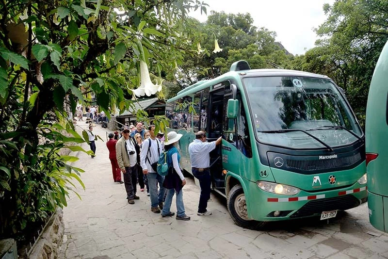
Once you have completed the hike from Hidroeléctrica to Machu Picchu Pueblo and had some rest, you will be ready to ascend and explore the Machu Picchu archaeological site. To do this, you will need a tour guide, either in a group service or a private one. This is the visit that attracts many travelers to Peru. Here’s how to reach the entrance gate from Aguas Calientes, as there are two ways to get there: by bus or on foot, with the latter being completely free.
1. By Bus: This is the fastest and most comfortable option. Buses depart from the center of Aguas Calientes and take you to the entrance of Machu Picchu in just 25 minutes. It is ideal for saving energy and fully enjoying the Machu Picchu archaeological site. The bus ticket costs $24 (round trip) for foreigners and $15 (round trip) for Peruvians.
2. Walking: You can reach Machu Picchu on foot via a steep but well-marked trail that takes you from the Puente Ruinas (Ruins Bridge) to the entrance of Machu Picchu in approximately 2 hours. This option is perfect for those who want to continue their hiking adventure from Hidroeléctrica, offering breathtaking views of the valley and the jungle—ideal for adventurers and hiking enthusiasts.
Bus-to-Machu-Picchu
Practical tips for your hike from Hidroeléctrica to Machu Picchu
1. Carry Cash: ATMs are limited in Hidroeléctrica and Aguas Calientes.
2. Wear Comfortable Shoes: Whether you plan to hike or not, good footwear is essential.
3. Stay Hydrated and Bring Snacks: There are few places to buy food along the route.
4. Protect Yourself from the Sun: Bring a hat, sunglasses, and sunscreen.
Machu Picchu Ticket Purchase 2025
Frequently Asked Questions (FAQ)
1. Is the route from Hidroeléctrica safe?
Yes, it is safe, but it’s always recommended to travel during the day, keep an eye on your belongings, and, if possible, walk in a group, the trail is well-marked with signposts leading to Aguas Calientes, and many other travelers take the same route.
2. Do I need a guide to reach Machu Picchu from Hidroeléctrica?
A Turistic guide is not required for the hike from Hidroeléctrica to Aguas Calientes, but it is mandatory to enter the Machu Picchu Historical Sanctuary on most of the new Machu Picchu 2025 circuits. Hiring a guide enhances the experience, as they provide detailed historical and cultural information.
3. What is the best time of year to do this route?
The dry season (April to October) is the best time, as there is less rain and more stable weather, during the rainy season (November to March), the trail can be slippery, and the views may be affected by fog.
4. Can I do the Hidroeléctrica to Machu Picchu route with children?
Yes, but ensure they are accustomed to long walks, and bring water, snacks, sunscreen, and proper clothing for their comfort, since the hike is nearly 13 kilometers long, there are no services along the way. The trail is flat and accessible, but walking at a pace suitable for them is important.
5. Are there restrooms or resting areas along the Hidroeléctrica hike?
There are no restrooms along the trail, but you’ll find facilities at the start of the hike and once you arrive in Aguas Calientes, there are a few spots where you can sit and rest, but no formal infrastructure.
6. Do I need to buy tickets in advance?
Yes, it is essential to purchase your Machu Picchu entrance tickets in advance, as they are not sold at the entrance, while you might find some of the 1,000 daily tickets available at the Ministry of Culture in Aguas Calientes, securing your preferred schedule and circuit can be difficult. During peak seasons, it may take up to three days to get a ticket.
7. Is it possible to hike at night?
It is not recommended to hike at night, as there is no lighting, and the path can be dangerous. It’s always best to walk during the day, which is why we recommend leaving Cusco at dawn since just reaching the starting point takes approximately 6 hours by car.
A-woman-in-Machu-Picchu-Mountain
The Hidroeléctrica to Machu Picchu route is an adventure that combines nature and culture, allowing you to immerse yourself in the beauty of the Urubamba Valley as you approach one of the world’s wonders. Whether you choose to hike along the river or take the train for panoramic views, each step brings you closer to the magic of this incredible destination.
At Kantu Peru Tours, we strive to provide the best information and services to make your trip unforgettable—from planning to exploring the majestic ruins of Machu Picchu. We hope this guide has been helpful, and if you have any more questions or want to share your experience, leave us a comment! Safe travels, adventurer! 🌄✈️
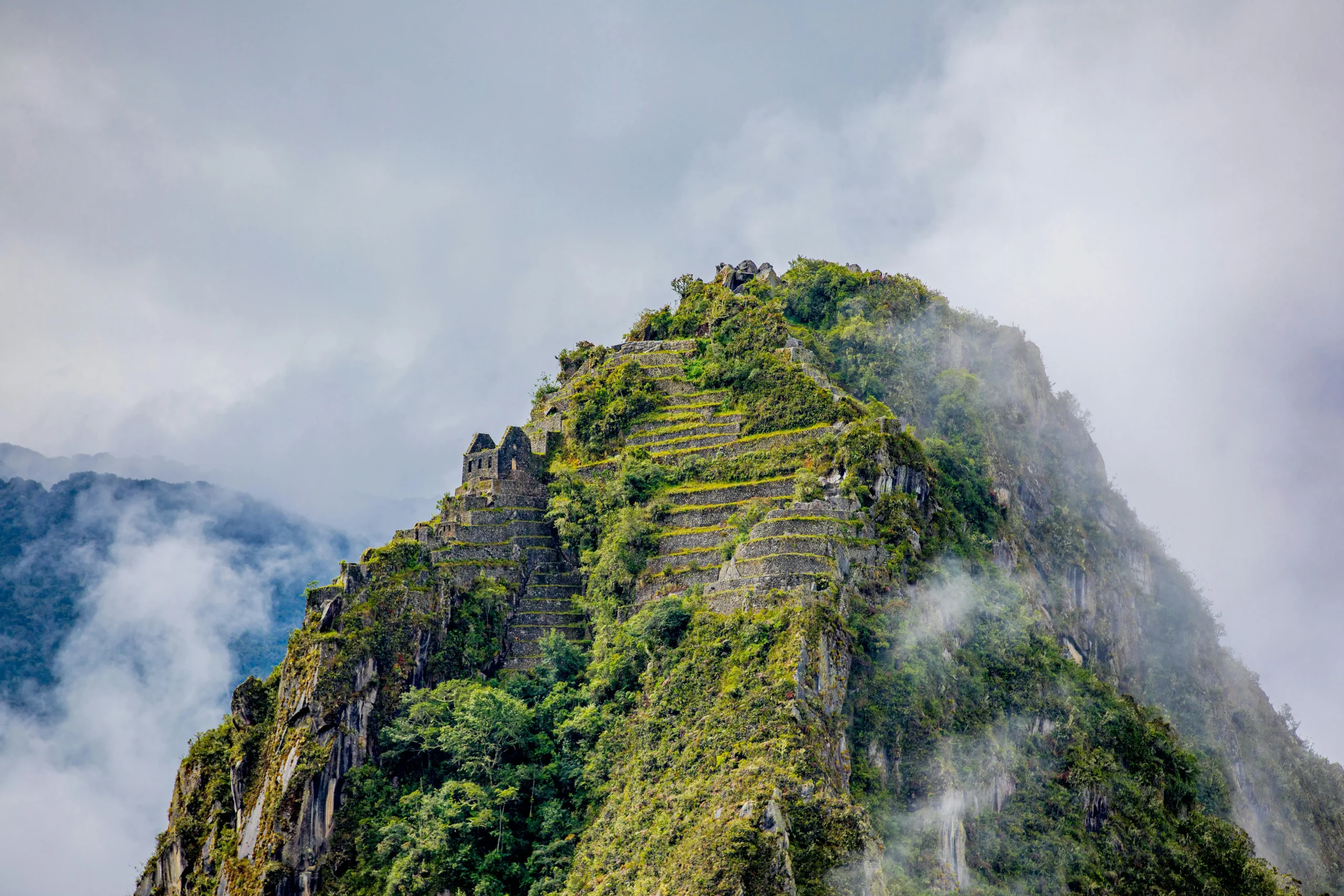
Rising dramatically behind the ancient ruins of Machu Picchu, Huayna Picchu Mountain is a destination that promises adventure, mystery, and breathtaking views. This iconic peak is more than just a backdrop for photos; it’s a journey into the heart of Inca history and culture. With its steep trails, ancient pathways, and fascinating archaeological remains, Huayna Picchu offers visitors a unique perspective of the majestic citadel and the surrounding Andes. Whether you’re seeking a thrilling climb or a deeper connection to the wonders of the Inca Empire, this mountain is a must-visit for anyone exploring Machu Picchu. Therefore, let Kantu Peru Tours guide you through everything you need to know, from planning your ascent to uncovering the secrets hidden along the trail. Get ready for an unforgettable adventure!
Montaña Huayna Picchu
What is Huayna Picchu Mountain?
Huayna Picchu Mountain is one of the most famous peaks around Machu Picchu. Even though it’s lower than Machu Picchu Mountain, the climb is much steeper and more challenging, making it perfect for thrill-seekers. From the top, you’ll get incredible views of the Inca citadel, the winding Urubamba River, and the surrounding mountains.
Huayna Picchu is not just about the views—it’s also full of history. Along the trail, you’ll find ancient terraces, Inca pathways, and temples. One of these temples was used as a burial site for the “Acllas” or Wives of the Sun, showing that this mountain had an important role in Inca religion and astronomy.
Huayna Picchu 360° view of Machu Picchu
A unique Machu Picchu’s perspective
Huayna Picchu Mountain offers a breathtaking 360-degree view at an altitude of 2,720 meters (8,923 feet) above sea level. From its summit, visitors enjoy unparalleled views of Machu Picchu and the surrounding landscapes:
1. View of Machu Picchu: Sitting 400 meters below, the entire Inca citadel, including its terraces and iconic structures, can be seen.
2. Urubamba River Valley: The winding river stretches across 15 kilometers, surrounded by lush Andean scenery.
3. Surrounding Mountains: Up to 30 kilometers of stunning Andean peaks create an imposing panorama.
Huayna Picchu Mountain Vistas
Huayna Picchu Mountain hike overview
1. Altitude: The mountain stands at 2,720 meters (8,923 feet), slightly lower than Machu Picchu Mountain but with a steeper and more challenging trail.
2. Trail Features: The Incas built narrow, steep steps surrounded by dense vegetation, and the trail includes resting points with spectacular views.
3. Summit Views: Enjoy 360-degree panoramas of Machu Picchu, the Urubamba River valley, and the Andean mountains.
4. Weather: Temperatures range from 12°C to 22°C (54°F to 72°F), with sudden weather changes. Lightweight and waterproof clothing is essential.
5. Photography Opportunities: The trail includes strategic viewpoints perfect for capturing unforgettable shots of Machu Picchu and its dramatic surroundings.
Urubamba River in Machu Picchu
Location of Huayna Picchu Mountain
Huayna Picchu Mountain is located within the Machu Picchu Archaeological Park in the Cusco region of Peru. Rising to 2,720 meters (8,923 feet) above sea level, this iconic peak is just 9 kilometers (5.5 miles) from Aguas Calientes. Accessible via a trail near the citadel, it is surrounded by cloud forests and the Urubamba River. Its cultural and spiritual significance is evident in its Inca terraces, temples, and pathways, making it a must-visit for history and nature lovers alike.
Huayna-Picchu-Mountain
Altitude and Huayna Picchu Mountain hike duration
The mountain rises 2,720 meters (8,923 feet) above sea level, with a climb of 290 meters (951 feet) from the citadel. The hike to the summit takes 1 to 1.5 hours, while the descent takes 40 minutes to 1 hour. Though the trail is challenging due to steep and narrow paths, the effort is well worth it. Keep in mind Machu Picchu’s altitude and its effects.
Reward: At the summit, you’ll enjoy 360-degree views of Machu Picchu, the Urubamba River, and the Andes, combining history, adventure, and stunning scenery.
Montaña Huayna Picchu Altura
Circuit map for Huayna Picchu mountain adventure
To visit Huayna Picchu, you must select Circuit Machu Picchu 3 (Route 3-A) when purchasing your ticket. This circuit includes the lower part of Machu Picchu, such as the Temple of the Sun and the Inca House, before beginning the climb to Huayna Picchu. The route, which lasts about 4 hours, offers exclusive views from the lower platform but does not include access to the Guardian’s House viewpoint. Designed for visitors over 18 years old, tickets must be booked at least 3 months in advance. This circuit is perfect for those seeking unique landscapes and an unforgettable challenge.
Machu Picchu Circuit 3 Map of the Huayna Picchu Mountain Route
How to Hike Huayna Picchu Mountain in Peru
Step 1: Travel to Aguas Calientes from Cusco
The first step for your adventure is traveling from Cusco or Ollantaytambo to Aguas Calientes, the main gateway to Machu Picchu. This charming town, surrounded by mountains, is the starting point for reaching Huayna Picchu Mountain. The only way to get there is by train ride to Machu Picchu operated by companies like PeruRail or Inca Rail, offering stunning views of the Andean landscape. Then, according to your departure point, the train ride takes 1.5 to 3.5 hours. Once you arrive in Aguas Calientes, you’ll be ready to begin your Machu Picchu experience and ascend the fascinating Huayna Picchu.
Train to Machu Picchu
Step 2: Reach Machu Picchu from Aguas Calientes
To get to Machu Picchu’s entrance, you have two options:
1. By bus: This is the easiest and most popular option. Buses to Machu Picchu run from early morning, taking about 30 minutes to reach Machu Picchu’s entrance via a zigzagging road. This saves energy for your hike to Huayna Picchu.
2. On foot: Ideal for those seeking a more active experience. The Machu Picchu hike from Aguas Calientes takes 1 to 2 hours and involves a steady uphill climb, offering beautiful views and a rewarding sense of accomplishment before entering Machu Picchu and continuing to Huayna Picchu.
Bus-a-Machu-Picchu
Step 3: Enter the Machu Picchu Complex
At the entrance to Machu Picchu, present your ticket, which must specifically include access to Huayna Picchu Mountain (Circuit 3-A). This permit is mandatory to access the trail, as entry is strictly controlled due to limited capacity. Without the correct ticket, you won’t be allowed to hike the mountain.
Note: If you want the classic postcard photo of Machu Picchu, you’ll need an additional ticket for Circuit 2-A or 2-B, which requires hiring a guide.
Huayna Picchu Photo from the sun gate route
Step 4: Begin the Huayna Picchu Hike
From Machu Picchu’s entrance, follow the signs to the trailhead for Huayna Picchu, located near the Huayrana sector. The trail starts with a gradual ascent but quickly becomes steeper and more challenging, with narrow steps carved into the rock by the Incas. While the trail is well-marked and can be done independently, having your specific Circuit 3-A ticket is essential. Prepare for an exhilarating hike with unique views and an intimate connection to this historical and natural wonder.
Entrance point for Huayna Picchu Hike
Step 5: Climb to the Summit of Huayna Picchu
The climb to Huayna Picchu is both thrilling and physically demanding due to its steep inclines and rugged terrain. Depending on your pace, the hike to the summit takes 1 to 2 hours. Along the way, you’ll encounter narrow paths and steep sections, including the famous “Stairway of Death.” Take breaks, stay hydrated, and enjoy the panoramic viewpoints offering breathtaking views of Machu Picchu and the surrounding valleys.
Escaleras de la muerte Huayna Picchu
Step 6: Enjoy the Views from the Summit
At 2,720 meters (8,923 feet) above sea level, the summit of Huayna Picchu offers unbeatable 360-degree views of Machu Picchu, Machu Picchu Mountain, and the winding Urubamba River. It’s the perfect spot to relax, take unique photos, and soak in the magic of the place before beginning your descent. Make sure you’re acclimated to the altitude to avoid discomfort during the hike.
Step 7: Descend Huayna Picchu
The descent follows the same trail and typically takes 1 to 1.5 hours, depending on your pace. Be cautious on steep sections and use handrails where available to avoid accidents. Once back at the entrance, you can continue exploring the Machu Picchu complex or head back to Aguas Calientes to rest and catch your return train. Make the most of every moment of this unique experience at one of the world’s most iconic sites.
A woman photo in Huayna Picchu Mountain
How to buy tickets for Huayna Picchu Circuit
Access to Huayna Picchu is limited, so it’s essential to book your tickets in advance. Tickets can be purchased directly from the official Machu Picchu website or through an authorized tour operator like Kantu Peru Tours. When buying your ticket, you’ll need to select a specific entry time, as tickets are assigned to designated time slots. Since only 200 people per time slot can hike Huayna Picchu, it’s highly recommended to book your tickets at least 3 months in advance, especially during peak season, to secure your spot for this unforgettable adventure.
Machu Picchu Ticket Purchase 2025
Entry time to Huayna Picchu Mountain
The entry times for Huayna Picchu Mountain are at 7:00 AM and 9:00 AM. It is recommended to arrive 30 minutes early to line up and avoid any issues with your entry time. You can stay in Machu Picchu for up to 6 hours from your entry time, but remember that your visit is limited to the circuit you selected. Unlike other trails, you don’t need to join a group or hire a tour guide, allowing for a more flexible experience.
Huayna Picchu stone and Mountain
Best time to hike Huayna Picchu Mountain
The best time to hike Huayna Picchu Mountain is during the dry season from May to October. During this time, the weather is mostly sunny, with temperatures ranging between 18°C and 25°C (64°F and 77°F), making it ideal for enjoying the scenery and the hike without worrying about rain.
If you plan to visit during the rainy season (November to April), expect more frequent rain, especially in the afternoon. However, you can still enjoy the hike by starting early in the morning when the weather is cooler. If visiting during this season, don’t forget to bring a poncho in case of rain.
Machu Picchu dry season weather
Comparison of Machu Picchu’s surrounding mountains
1. Machu Picchu Mountain: The highest at 3,082 meters (10,100 feet), with a 3-4 hour round trip hike. Less steep, ideal for all ages seeking a moderate challenge and broad views. Its trails offer incredible panoramic vistas of the entire archaeological site and surrounding mountains.
2. Huayna Picchu Mountain: At 2,700 meters (8,850 feet), it offers a 1.5-2 hour steep, narrow hike. Challenging and restricted to those 18+ due to difficulty. The summit rewards hikers with unique views of Machu Picchu and the winding Urubamba River.
3. Huchuy Picchu Mountain: The smallest at 2,500 meters (8,200 feet), with a moderate 1.5-2 hour hike. Restricted to ages 12+. This shorter trail is perfect for those wanting a less intense hike with scenic views.
Comparison from all Machu Picchu Mountains
Rules to avoid penalties in Huayna Picchu Mountain
1. Stay on marked trails: Follow the designated paths and do not stray from the routes.
2. Adhere to entry times: Arrive on time to avoid penalties or issues.
3. Drone ban: Flying drones within the park is strictly prohibited.
4. No food allowed: Bringing or consuming food within the park is not permitted.
5. Avoid large backpacks: Carry only essentials in a small bag to comply with park regulations.
Huayna Picchu Photo
Tips and equipment for hiking Huayna Picchu Mountain
1. Footwear: Wear durable hiking boots with good traction for uneven terrain.
2. Clothing: Dress in layers to adjust to temperature changes and bring a waterproof jacket for rain.
3. Essentials: Carry water, energy snacks, sunscreen, and insect repellent to stay protected and energized.
4. Physical preparation: Acclimate to the altitude beforehand to reduce the risk of altitude sickness.
5. Tickets and passport: Bring your Huayna Picchu or Machu Picchu ticket and passport for registration at the entrance.
Mujer tomando foto en Machu Picchu
FAQs About Huayna Picchu Mountain
1. How long does it take to hike Huayna Picchu Mountain?
The hike to the summit typically takes 1.5 to 2 hours each way, depending on your pace. Including time to rest and enjoy the views, you can stay a maximum of 6 hours within the circuit.
2. Is the hike suitable for beginners?
No, due to its steep inclines and narrow paths, this hike is better suited for those with moderate to advanced fitness levels. For an easier adventure, consider hiking to Inti Punku (Sun Gate) or the Last Inca Bridge instead.
3. Do I need a guide for the hike?
A guide is not required, as the trail is well-marked. However, hiring a guide can enhance your experience with cultural and historical insights. Keep in mind that for the classic Machu Picchu photo, you’ll need an additional ticket for Circuit 2-A or 2-B, which does require a guide.
4. When is the best time to visit Huayna Picchu Mountain?
The dry season, from May to October, is ideal for clearer views and better weather conditions. If visiting during the rainy season, morning hikes are generally more stable.
5. How can I get tickets for Huayna Picchu Mountain? Tickets must be purchased in advance due to limited access. It’s recommended to book 3 months prior through the official Machu Picchu website or authorized operators like Kantu Peru Tours.
6. Can I bring food or drinks on the hike?
Food is not allowed in the park, but you can carry a small bottle of water to stay hydrated.
7. Are there age restrictions for the hike?
Yes, Huayna Picchu is restricted to individuals 18 years or older due to the trail’s difficulty. For families, Machu Picchu Mountain is a better option with no age restrictions.
Huayna Picchu Photo from the main platform perspective
Hiking Huayna Picchu Mountain is a thrilling experience, offering breathtaking views and a deep connection to Machu Picchu’s history and natural beauty. Despite its physical challenges, each step rewards you with unforgettable panoramas and a sense of accomplishment. For a tailored adventure, Kantu Peru Tours provides expert guides and personalized itineraries, ensuring your trip is both seamless and memorable. Don’t miss the opportunity to explore the best of Peru!
Embarking on a journey to Machu Picchu Mountain promises an extraordinary adventure, presenting awe-inspiring vistas of the renowned Inca ruins and the encompassing Andean highlands. This trail is perfect for travelers in search of a moderately challenging climb paired with unforgettable scenery. As a quieter alternative to the bustling pathways of the citadel, the ascent to Machu Picchu Mountain allows you to immerse yourself in the serene beauty of this UNESCO World Heritage Site. Whether you’re an experienced hiker or a curious explorer, this comprehensive guide by Kantu Peru Tours provides all the details you need to make your trek to Machu Picchu Mountain a remarkable and enriching experience.
A-woman-in-Machu-Picchu-Mountain
What is Machu Picchu Mountain?
Machu Picchu Mountain, or Cerro Machu Picchu, is one of the two towering peaks that form the backdrop of the legendary Inca citadel. Unlike the more famous Huayna Picchu, which looms dramatically above the ruins, Machu Picchu Mountain rises on the opposite side and offers a less strenuous and more serene hiking experience. Standing at an impressive altitude of approximately 3,082 meters (10,111 feet) above sea level, this peak provides some of the most breathtaking panoramic views of the Machu Picchu archaeological site, the lush Andean jungle, and the winding Urubamba River below.
Machu Picchu Mountain Panoramic photo
A unique perspective of Machu Picchu Citadel
Machu Picchu Mountain offers an unforgettable way to experience the grandeur of the Inca civilization and the natural beauty of the Andes. Whether you’re a nature lover, an avid hiker, or simply looking for a quieter alternative to the bustling Huayna Picchu, this hike promises a journey filled with wonder, serenity, and inspiration. If you’re planning a trip to Machu Picchu, don’t miss the chance to conquer this remarkable peak—it’s an adventure that will stay with you for a lifetime!
Machu-Picchu-Mountain
Key Facts About the Hike
1. Height: 3,082 meters (10,111 feet) above sea level, higher than the citadel and Huayna Picchu.
2. Trail Features: Stone steps built by the Incas, surrounded by lush vegetation and scenic viewpoints.
3. Summit Views: Offers 360-degree panoramic vistas of the citadel, Huayna Picchu, and surrounding mountain ranges.
4. Temperature and Weather: Ranges from 10°C to 25°C (50°F to 77°F); be ready for sudden weather changes.
5. Photography Opportunities: Perfect spots for capturing the citadel and the dramatic Andean landscapes.
Machu-Picchu-Mountain-Trekers
Where is Machu Picchu Mountain Located?
Machu Picchu Mountain, or Cerro Machu Picchu, is located within the Machu Picchu Archaeological Park in the Cusco region of Peru. Standing at 3,082 meters (10,111 feet) above sea level, it offers breathtaking views of the surrounding Andes and the famous Inca citadel. Situated just behind the citadel, it contrasts with the steeper Huayna Picchu on the opposite side. The mountain is accessible from the citadel’s main entrance, with its trailhead conveniently located nearby.
Just 9 kilometers (5.6 miles) from Aguas Calientes, the mountain is surrounded by lush cloud forests and the Urubamba River, creating a stunning natural backdrop. As a sacred site for the Incas, it holds cultural and spiritual significance while also being part of the biodiverse Vilcabamba range, making it a perfect destination for both hikers and history enthusiasts.
Montaña Machu Picchu Fotos
Altitude gain of Machu Picchu Mountain
Hiking to the summit of Machu Picchu Mountain involves an altitude gain of approximately 652 meters (2,139 feet), starting from the citadel at 2,430 meters (7,972 feet) and reaching the peak at 3,082 meters (10,111 feet). The trail consists of well-preserved Inca stone steps, winding through lush vegetation and offering increasingly stunning viewpoints as you ascend.
The climb typically takes 1.5 to 2 hours up and about 1 to 1.5 hours down, depending on your fitness level and pace. While the hike is challenging due to the altitude and steady incline, it is considered less steep and more accessible than Huayna Picchu. Hikers are advised to acclimatize in Cusco or nearby areas to minimize the risk of altitude sickness, and breaks along the way are essential to enjoy the scenery and adjust to the thinner air.
The reward: breathtaking, 360-degree panoramic viewsof the Machu Picchu citadel, Huayna Picchu, the surrounding Andean peaks, and the winding Urubamba River below.
Machu Picchu Mountain Altitude
Machu Picchu Mountain route Map
The Machu Picchu Mountain route, part of Circuito Machu Picchu 1 (Ruta 1-A), offers a scenic hiking experience starting near the citadel’s entrance. The trail spans about 2 kilometers (1.2 miles) each way and takes around 3 hours round trip, with an altitude gain of 652 meters (2,139 feet). Along the way, hikers pass the Casa del Guardián, offering iconic views of the citadel, and enjoy panoramic vistas of Machu Picchu and the surrounding Andes. Access to the urban ruins is not included on this route, and an additional ticket is required to explore the archaeological site due to the new 2025 circuits in Machu Picchu proposed by the government. The hike is ideal for nature lovers and trekkers, with the full experience lasting around 4 hours, including breaks and photography.
Machu Picchu Circiit 1 Map of the Machu Picchu Mountain Route
How to do the Machu Picchu Mountain hike in Peru?
Step 1: Getting to Aguas Calientes from Cusco
Begin your journey by traveling from Cusco or Ollantaytambo to Aguas Calientes (Machu Picchu by Train), the town at the base of Machu Picchu. The only and scenic way is by train, with several operators offering routes. The trip typically takes 1.5 to 3.5 hours depending on your departure point. Once you arrive in Aguas Calientes, you’ll be ready to head up to the Machu Picchu complex.
Machu Picchu by Train
Step 2: Getting to Machu Picchu from Aguas Calientes
You have two options from Aguas Calientes to reach theMachu Picchu entrance. The most common choice is a 30-minute bus ride, which takes you up the winding road to the entrance. Alternatively, if you’re up for more exercise, you can hike uphill for 1–2 hours, passing through the lush forest and enjoying the scenic views.
Bus-to-Machu-Picchu
Step 3: Entering the Machu Picchu Complex Site
At the entrance, present your ticket for Machu Picchu. Make sure your ticket specifically includes access to Machu Picchu Mountain wich is the circuit 1-A, as this hike requires a separate permit. Without this permit, you won’t be able to access the mountain trail.
Hike-start-point-to-the-Machu-Picchu-Mountain
Step 4: Starting the Hike to Machu Picchu Mountain
Once you’ve entered the Machu Picchu complex, follow the signs to the trailhead, which is located near the agricultural terraces. The trail begins gently, and you’ll gradually start ascending towards the summit. Follow the markers to ensure you’re on the correct path. Having a tour guide for this extra hike is not mandatory as Machu Picchu Citadel needs.
Step 5: Hiking to the Summit of Machu Picchu Mountain
The trail is well-maintained but can be steep in some areas, so take your time and pace yourself. Depending on your fitness level, the hike typically takes 1.5 to 2 hours. Be sure to take regular breaks to rest and hydrate. The trail offers several stunning viewpoints as you ascend, with glimpses of Machu Picchu below.
Machu-Picchu-Mountain-hike
Step 6: Enjoying the views
Upon reaching the summit at 3,082 meters (10,111 feet), you’ll be treated to unmatched panoramic views of the Machu Picchu complex, Huayna Picchu, and the surrounding valleys. The views are perfect for photos and a well-deserved rest before heading back down. Keep in mind that Machu Picchu altitude is lower than Machu Picchu Mountain, therefore make sure you have keys to avoid altitude sickness in Cusco region.
Step 7: Descend
After soaking in the breathtaking views, it’s time to descend. Return along the same trail, being cautious on the steeper downhill sections. The descent typically takes 1 to 1.5 hours. Once back at the Machu Picchu entrance, you can take some time to explore other areas of the citadel, or catch the bus back to Aguas Calientes for your return journey.
Machu-Picchu-Mountain-Group-Tour
Machu Picchu Mountain Tickets: How to Get Them?
Tickets for Machu Picchu Mountain are limited and must be purchased in advance. You can obtain tickets through the official Machu Picchu website. or via a licensed tour operator like Kantu Peru Tours. Each ticket includes a designated time slot for entry, so it’s important to select your preferred time when booking. Since the number of tickets is restricted, it’s recommended to purchase them early, particularly during peak tourist seasons.
Machu Picchu Ticket Purchase 2025
Schedule for Machu Picchu Mountain
There are two entry groups for Machu Picchu Mountain: 7:00 AM and 9:00 AM. Since access is limited, it’s recommended to arrive at least 30 minutes before your scheduled entry time to check in and prepare for your hike. Unlike other trails like the Sun gate or Inca Bridge, you don’t need to worry about additional restrictions or group arrangements for this hike, providing a more personal and flexible experience for adventurers.
Machu-Picchu-from-Machu-Picchu-Mountain-Hike
The best time to hike Machu Picchu Mountain
The best time to hike Machu Picchu Mountain is during Peru’s dry season from May to October. This period offers sunny weather, with daytime temperatures ranging from 18°C to 25°C (64°F to 77°F), and little rain. This makes for clear skies and perfect hiking conditions.
While the rainy season (November to April) brings more frequent showers, hiking is still possible, especially in the morning, when temperatures are cooler, around 14°C to 20°C (57°F to 68°F). It’s advisable to bring a poncho if visiting during this time, as rain typically falls in the afternoon.
Machu Picchu dry season weather
Comparing Machu Picchu Mountain, Huayna Picchu, and Huchuy Picchu Mountains
Machu Picchu Mountain
Length of Hike: 3 to 4 hours
Difficulty: Difficult. Longer trail but less steep.
Elevation at the summit: 3,080 m or 10,100 ft
Buying Tickets: Can be bought a few days prior (a couple of weeks in peak season is recommended.)
Children Allowed: Yes. All ages are allowed.
Machu-Picchu-Mountain-Hike-photos
Huayna Picchu Mountain
Length of Hike: 1.5-2 hours return
Difficulty: Difficult. Shorter trail with a steeper incline.
Elevation at the summit: 2,700 m or 8,850 ft
Buying Tickets: Usually book up months in advance. Should be purchased six months prior.
Children Allowed: Under the age of 12 is not allowed
Huayna-Picchu-Mountain
Huchuy Picchu Mountain
Length of Hike: 1.5-2 hours return
Difficulty: Moderate. The trail is shorter but has a steeper incline than others.
Elevation at Summit: 2,500 meters (8,200 feet)
Buying Tickets: Tickets are often booked months in advance, so it’s best to purchase them at least six months prior.
Children Allowed: Children under the age of 12 are not allowed on the trail to Huchuy Picchu Mountain.
Huchuy Picchu Mountain View from the front side
Characteristics of the Mochu Picchu Mountain hike
1. Challenging hike, with many unable to complete the entire route.
2. After 30 minutes, an incredible viewpoint offers stunning views if you choose to turn back.
3. Two time slots for hiking, from 7:00 AM to 8:00 AM or 8:00 AM to 9:00 AM.
4. Register at the trailhead and sign out when finished.
5. Limited shade on the trail; bring a hat and sunscreen.
Montaña Machu Picchu
Key regulations to avoid fines at Machu Picchu Mountain
1. Stay on marked trails: Do not stray from the designated paths.
2. Respect entry times: Arrive at your scheduled time to avoid penalties.
3. No drones: Flying drones is prohibited within the park.
4. No food: Eating or bringing food into the park is not allowed.
5. Permits required: Ensure you have the necessary permit for hiking Machu Picchu Mountain.
6. No large bags: Carry only essential items in small bags.
Machu Picchu Mountain Hike
Preparation tips and gear for hiking Machu Picchu Mountain
1. Footwear: Sturdy hiking boots with good traction
2. Clothing: Layered clothing, including a waterproof jacket
3. Essentials: Water, snacks, sunscreen, and insect repellent
4. Fitness: Acclimate to the altitude before attempting the hike
Machu Picchu Gears
Frequently asked questions of the Machu Picchu Mountain
Here are some additional travel-related questions and answers:
1. How long does it take to hike Machu Picchu Mountain?
The hike takes 3 to 4 hours round trip.
2. Is the hike suitable for beginners?
Yes, though it requires a moderate level of fitness.
3. Do I need a guide?
No, but guides are available in a private service for those seeking additional insights into the history and surroundings.
4. Can I hike during the rainy season?
Yes, but trails may be slippery. Be sure to prepare with proper gear like a poncho and sturdy shoes.
5. What is the best time to visit Machu Picchu Mountain?
The best time is during the dry season (May to October), when the weather is sunnier and ideal for hiking.
6. How do I get tickets for the Machu Picchu Mountain hike?
Tickets should be purchased in advance through the official website or a licensed tour operator, as they are limited.
7. Can I bring food or drinks on the hike?
No, food and drinks are prohibited inside the park, except for small amounts of water.
8. Are there age restrictions for the hike?
Children under 12 years old are not permitted on the Machu Picchu Mountain hike.
Machu Picchu Views from Machu Picchu Mountain Trail
The Machu Picchu Mountain hike offers an incredible, less crowded experience with breathtaking views of Machu Picchu, Huayna Picchu, and the surrounding Andes. Though challenging, the trail rewards hikers with stunning viewpoints and a deeper connection to the site’s natural beauty. For a fully customized experience, Kantu Peru Tours can help design your perfect journey. They offer expert guides and tailor-made itineraries, whether you prefer a leisurely visit or a more adventurous hike. With personalized services and secure bookings, Kantu Peru Tours ensures your Machu Picchu adventure is unforgettable. Reach out to them for a unique and seamless travel experience in Peru.
Hiking to Huchuy Picchu Mountain offers an incredible experience, perfect for those looking for a shorter, less strenuous adventure with spectacular views of the Machu Picchu ruins. As part of your visit to the famous archaeological site, this trail is a great option for those who want to enjoy the beauty of the Andes without the intense challenge of longer hikes like Machu Picchu Mountain or Huayna Picchu. Whether you’re a first-time hiker or an experienced adventurer, this guide, brought to you by Kantu Peru Tours, will provide you with everything you need to know to make your hike to Huchuy Picchu a success.
What is Huchuy Picchu Mountain in Machu Picchu?
Nestled in the Peruvian Andes, Huchuy Picchu Mountain, often called “Little Picchu,” is a lesser-known but captivating peak near the iconic Machu Picchu. Although it is overshadowed by its more famous counterpart, Huchuy Picchu Machu Picchu holds its own historical and architectural significance, featuring ancient terraced fields, ceremonial buildings, and residential areas. These remnants are believed to have been part of a royal estate for the Inca nobility, showcasing the advanced stonework and engineering that defined the Inca Empire.
Offering a more private and tranquil experience than the more crowded Huayna Picchu and Machu Picchu mountains, Huchuy Picchu Mountain provides a peaceful escape for travelers seeking to immerse themselves in Inca heritage. Its remote location and smaller size make it an ideal choice for those looking for a quiet, reflective adventure away from the bustle of the larger tourist sites.
Tourists at Huchuy Picchu Mountain
Guardian of Machu Picchu and the Temple of Coca
Huchuy Picchu Mountain, or “Little Picchu,” is a lesser-known but significant peak near Machu Picchu. Positioned above the citadel, it is believed to have served as a protector “Apu” of the sacred site, potentially housing a temple dedicated to the coca leaf, a plant valued by the Incas for its energy-boosting properties. Today, coca remains an important part of local culture, often used to alleviate altitude sickness.
Some theories suggest that the three mountains—Machu Picchu, Huayna Picchu, and Huchuy Picchu—form a symbolic trinity representing different stages of life: Elder, Youth, and Newborn. While this remains a hypothesis, it highlights the deep cultural and spiritual significance of these peaks in Inca tradition, making Huchuy Picchu Mountain a fascinating destination for travelers seeking both history and serenity.
Where is Huchuy Picchu Mountain located?
Huchuy Picchu Mountain is located to the north of the Machu Picchu archaeological site, next to the famous Huayna Picchu Mountain. This mountain is part of the Machu Picchu complex and offers an exciting adventure with stunning views and rich history.
This short but captivating trek is only included in a specific ticket for the 10 new circuits in Machu Picchu in 2025. The closest town is Aguas Calientes, also known as Machu Picchu Pueblo, which is situated along the Urubamba River, making it a perfect base for exploring Machu Picchu and its surrounding mountains, including Huchuy Picchu.
Huchuy Picchu Mountain
Altitude gain of Huchuy Picchu mountain
The trek to Huchuy Picchu Mountain involves an altitude gain of about 300 meters (984 feet). Starting from the Machu Picchu site altitude, which is located at around 2,430 meters (7,970 feet), the summit of Huchuy Picchu rises to 2,500 meters (8,200 feet) above sea level.
This moderate ascent offers visitors an accessible yet rewarding hike, with panoramic views of Machu Picchu and the surrounding landscapes. The relatively short climb makes it a great option for those looking to explore more of the Machu Picchu complex while enjoying a peaceful and scenic experience.
Montaña Huchuy Picchu Altura
Huchuy Picchu route Map
This map shows how to reach Huchuy Picchu from the main entrance of the Machu Picchu citadel. Click on the image to enlarge for a clearer view.
If you’d like to add Huchuy Picchu to your Machu Picchu itinerary, be sure to select the “Circuit 3 + Huchuy Picchu” option when purchasing your ticket.
We recommend starting your visit by exploring the lower terraces of Machu Picchu with a 2.5-hour private tour. Afterward, take the short 1.5 to 2-hour round-trip hike up Huchuy Picchu, where you’ll enjoy scenic views of the ruins and surrounding landscape.
Be sure to check out our blog post on Machu Picchu circuits for more detailed information on how to plan your visit!
Machu Picchu Circuit 3 Map of the Huchuy Picchu Mountain Route
How to do the Huchuy Picchu Hike in Peru?
Step 1: Getting to Aguas Calientes from Cusco
Most visitors reach Aguas Calientes, the gateway to Machu Picchu, by train from Ollantaytambo or Poroy. Alternatively, adventurous travelers may choose to walk the Inca Trail, which can take 2 to 4 days. Aguas Calientes is nestled along the Urubamba River, surrounded by lush jungle and mountains, and serves as the primary base for exploring Machu Picchu.
Step 2: Getting to Machu Picchu from Aguas Calienets
From Aguas Calientes, you can either:
1. Hike to Machu Picchu:(60-90 minutes), following a well-trodden path that winds uphill. While the walk offers more immersion in nature, it’s steep and can be tiring.
2. Take the bus:(20 minutes), a quicker and more comfortable option that takes you directly to the Machu Picchu entrance. If you’re pressed for time or prefer a less strenuous start, the bus is your best bet.
Aguas-Calientes-Trail-to-Machu-Picchu
Step 3: Entering the Machu Picchu complex site
Once you reach the Machu Picchu entrance, head to the lower gates of Circuit 3, which provide access to Huchuy Picchu. The mountain trail is located just 25 meters (82 feet) from the main entrance. This is where your adventure begins, and from here, you’ll start the hike up.
Step 4: Starting the hike to Huchuy Picchu Machu Picchu
At the control point, you’ll notice a fork in the path. Make sure to stay to the left to begin the climb to Huchuy Picchu. The trail is clear, marked by Inca stone steps, and well-maintained, making it easy to follow. This section of the hike is often quieter compared to other trails, giving you a more peaceful experience.
Huchuy Picchu entrance trail
Step 5: Hiking to the summit of Huchuy Picchu
The hike to the summit of Huchuy Picchu is about 1 kilometer (0.6 miles), and the ascent takes roughly 15 minutes. The climb is gradual but steady, with an elevation gain of about 70 meters (220 feet). As you ascend, you’ll pass sections with steep drop-offs, though the wide trail provides plenty of support to hold onto. The path is rough in some areas, so it’s best suited for those in reasonable physical condition.
Step 6: Enjoying the Views
As you make your way up, you’ll be rewarded with breathtaking views of Putucusi mountain and the Urubamba River below. The scenery improves as you rise higher, and once at the summit, you’ll enjoy a panoramic view of Machu Picchu from the north side. While the summit is a bit lower than Huayna Picchu, you still get a fantastic perspective of the ruins, as well as a closer look at Huayna Picchu, with hikers visible on its steep path.
A woman in Huchuy Picchu
Step 7: Descend
After soaking in the magnificent views, it will take you around 10 minutes to descend back to the Machu Picchu entrance. The trail is manageable, making the return journey just as quick and easy as the ascent. Once back, you can continue exploring the main site of Machu Picchu or relax in Aguas Calientes, reflecting on your memorable hike up Huchuy Picchu.
Huchuy Picchu Hike: What to Expect?
The Huchuy Picchu hike is short and straightforward, with a total climb of about 1 kilometer (0.6 miles). The path features stone steps built by the Incas, and while some parts have steep drop-offs, the trail is wide and safe, making it accessible for most hikers. However, it’s not recommended for those with limited mobility due to the rough terrain.
With a moderate pace, it takes about 15 minutes to reach the summit, and only 10 minutes to descend. Along the way, you’ll enjoy amazing views of Putucusi mountain and the Urubamba River, which become even more spectacular as you climb higher. Once at the summit, you’ll be at an elevation of 2,497 meters (8,192 feet), offering panoramic views of Machu Picchu from the north side. Though the view is slightly lower than from Huayna Picchu, you can enjoy a unique perspective, including a closer look at Huayna Picchu and tiny hikers making their way up its slopes.
Huchuy Picchu Mountain View from the front side
Huchuy Picchu Tickets: How to Get Them?
To hike Huchuy Picchu, you must purchase your tickets in advance through the official website at https://tuboleto.cultura.pe. It’s important to only buy tickets from this site, as purchasing from unofficial sources may lead to issues. Please note that it’s not possible to buy tickets on the spot at Machu Picchu, so make sure to reserve them online ahead of time.
Though Huchuy Picchu is less popular than nearby Huayna Picchu, it still requires a reservation, especially if you have a specific date or time in mind. A tour guide is optional for this hike—while you can hire one at the entrance of Machu Picchu, it’s not necessary for the trail.
Machu Picchu Ticket Purchase 2025
Hours & Fees for Huchuy Picchu Mountain
The entire Machu Picchu complex is open daily from 6:00 AM to 5:30 PM. While visits are technically limited to a few hours, staff typically doesn’t enforce this, allowing visitors to stay as long as they want unless there are any issues.
For the Huchuy Picchu hike, tickets are divided into time slots to minimize congestion. There are 25 tickets available per time slot (200 total per day). You’ll need to select your preferred time, but once inside the Huchuy Picchu control gate, you can stay as long as you like. The current ticket price for Huchuy Picchu is 152 soles (~$40 USD) for adults, which includes access to Huchuy Picchu and Circuit 4 of Machu Picchu. There is a 50% discount for students and minors (ages 3-17).
Machu Picchu Top View
Flora and fauna of Huchuy Picchu
The flora of Huchuy Picchu is incredibly diverse, featuring trees such as cedar, queñuales, and molle, along with a variety of ferns and stunning orchids. It is estimated that Machu Picchu is home to over 200 species of orchids, creating a vibrant, life-filled landscape along the trail.
As for the fauna, the area hosts a wide range of butterflies and birds, with the iconic cock of the rock, Peru’s national bird, standing out—though it is difficult to spot. Additionally, mammals such as the spectacled bear, Andean deer, and llamas can be seen roaming freely around the Machu Picchu ruins. This rich biodiversity adds a magical touch to the experience of visiting Huchuy Picchu.
Colibrí de Pecho Castaño en Machu Picchu
When to visit Huchuy Picchu: Best Time to Hike
The best time to hike Huchuy Picchu and explore the Machu Picchu complex is during Peru’s dry season, which lasts from May to October. This period offers more sunshine and significantly less rain, making it ideal for outdoor adventures. The clear skies enhance your views of the stunning Andes mountains and the ancient Inca ruins, offering the perfect conditions for your hike.
However, don’t completely discount the rainy season, which runs from November to April. We hiked Huchuy Picchu in January and had decent weather, with rain typically arriving in the afternoon or evening. If you visit during this time, it’s smart to bring a poncho, as conditions can change quickly. For the best experience, try to hike Huchuy Picchu in the late morning. The Andean mist often clears by this time, giving you breathtaking views of the mountain landscape, while fewer tourists make for a more peaceful experience.
Mujer tomando foto en Machu Picchu
Comparing Huchuy Picchu, Machu Picchu, and Huayna Picchu Mountains
Exploring the historical, cultural, and scenic treasures of Huchuy Picchu, Machu Picchu, and Huayna Picchu is an adventure every traveler should experience. While each mountain offers unique views and challenges, all three provide incredible perspectives of the Machu Picchu ruins, making them unforgettable.
Keep in mind that no matter which mountain you choose to hike, you’re in for an unforgettable experience. Whether you prefer a shorter, easier climb with Huchuy Picchu or a more challenging ascent with Huayna Picchu, the panoramic views of Machu Picchu will make the journey worthwhile.
Comparison from all Machu Picchu Mountains
Huchuy Picchu Mountain:
Ticket Needed: Circuit 3 Route 3D
Hike Duration: 1.5 – 2 hours (round trip), approximately 2.5 km (1.5 miles)
Elevation Gain: 2,497 meters (8,192 feet)
Difficulty: Moderate
Ticket Needed: Circuit 3 Route 3
Hike Duration: 1.5 – 2 hours (round trip), approximately 2 km (1.25 miles)
Elevation Gain: 2,692 meters (8,825 feet)
Difficulty: Moderate to Difficult
Huayna-Picchu-Mountain
What you need to know to avoid fines at Machu Picchu
Machu Picchu is not only a significant archaeological site but also a protected sanctuary. In order to preserve the environment, walls, and flora and fauna, strict regulations are in place to avoid any disruption. Here are the key rules to follow:
Large backpacks are not allowed.
Small snacks and beverages are permitted, but be sure to avoid leaving any trash behind.
Loud noises and music are prohibited.
Professional or large recording equipment is not allowed.
Drones are strictly forbidden.
A photograper in Machu Picchu
Permits and regulations for hiking Huchuy Picchu
To hike Huchuy Picchu, make sure to purchase the “Circuit 3 + Huchuy Picchu” ticket in advance, as only 500 tickets are available each day, with 100 per time slot. Book at least one month ahead to secure your spot.
Visitors must follow strict rules to preserve the site: large backpacks are not allowed, and only small snacks and drinks are permitted—ensure no litter is left behind. Loud noise, music, and the use of professional recording equipment are prohibited, as well as drones. Always adhere to these regulations to avoid penalties.
View from Huchuy Picchu Mountain Trail
Preparation tips and gear for hiking Huchuy Picchu
To ensure a smooth and enjoyable hike to Huchuy Picchu, be sure to pack the following essentials:
• Sturdy hiking shoes with good traction
• Layered clothing for varying temperatures, including warm layers and a waterproof jacket
• Small backpack to carry your gear
• Reusable water bottle
• Energy snacks to keep you fueled
• Charged smartphone for photos or emergencies
• Sun protection: hat, sunglasses, and sunscreen
• Insect repellent
Fotografia con la motana Huchuy Picchu de fondo
Frequently asked questions
How long does it take to hike Huchuy Picchu?
The hike takes around 1.5 to 2 hours (round trip), depending on your fitness level and pace.
What is the difficulty of the Huchuy Picchu hike?
The hike is considered moderate. While it includes some uphill stretches and uneven terrain, it’s not as strenuous as other hikes like Machu Picchu Mountain or Huayna Picchu.
What views can I expect from Huchuy Picchu?
From the summit, you’ll be rewarded with stunning panoramic views of the surrounding Andean landscape, including lush valleys, mountain peaks, and the iconic Machu Picchu ruins.
Do I need to be in good shape to reach the summit of Huchuy Picchu?
The hike is moderate, so a reasonable level of fitness is recommended, but it’s not overly challenging for most hikers.
Is the hike to Huchuy Picchu worth it?
Definitely! It’s a quick but rewarding hike with breathtaking views, offering a more peaceful and less crowded experience compared to other hikes at Machu Picchu.
Huchuy Picchu vs. Huayna Picchu: Which is better?
Huchuy Picchu offers a peaceful and relaxing hike with beautiful views and fewer crowds. Huayna Picchu, on the other hand, is more challenging, with narrower, steeper paths but also offers amazing views for more adventurous hikers.
Which circuit takes you to Huchuy Picchu?
To reach Huchuy Picchu, take Circuit 3 (Route 3D). You’ll explore the lower areas of Machu Picchu before ascending to the summit.
Is it necessary to hire a guide for the Huchuy Picchu hike?
A guide is not mandatory for the Huchuy Picchu hike. However, you can hire one at the entrance of Machu Picchu if you prefer a more informative experience.
Can I visit Huchuy Picchu during the rainy season?
While the rainy season (November to April) brings more precipitation, the hike can still be done, but trails may be slippery. Be prepared for unpredictable weather and carry a poncho.
What time should I visit Huchuy Picchu for the best experience?
Late morning is the ideal time to hike Huchuy Picchu as the mist typically clears, offering the best views of the surrounding mountains.
Caminata a la montaña Huchuy Picchu
Huchuy Picchu offers a unique, rewarding hiking experience with panoramic views of Machu Picchu and the surrounding Andean landscape. Whether you’re looking for a peaceful escape from the crowds or simply want to explore more of this breathtaking region, the Huchuy Picchu trail provides a memorable adventure. By planning ahead, following the necessary regulations, and being prepared with the right gear, you’re sure to have an unforgettable journey. We at Kantu Peru Tours hope this guide helps you make the most of your visit to Huchuy Picchu, and we look forward to helping you create amazing memories in the heart of the Inca Empire.
Machu Picchu, one of the Seven Wonders of the World, draws thousands of visitors each year eager to walk in the footsteps of the ancient Incas. Aguas Calientes, also known as Machu Picchu Pueblo, is this iconic site’s most popular gateway town. Nestled at the foot of the Andes, this village is where the journey to the legendary Inca citadel begins. Therefore thanks to Kantu Peru Tours here’s a comprehensive guide about the Aguas Calientes to Machu Picchu Hiking trail on your own, that includes, characteristics of the route, advantages, map trail, and tips to have an incredible journey in Machu Picchu.
What is Aguas Calientes? A Brief Overview of the Town
Aguas Calientes is a small town in the Urubamba province of Cusco, Peru, just a few kilometers from Machu Picchu. Initially a settlement for workers building the railway to Machu Picchu, the town’s popularity grew as the site gained worldwide recognition. Today, it has evolved into a key tourist hub, offering essential services and accommodations for visitors.
After the railway was completed in 1929, the town experienced rapid growth, expanding to occupy the limited space available due to its geography. This compact layout makes it ideal for tourists, as everything is within walking distance. Visitors can easily access buses to Machu Picchu and the train that connects Cusco to Aguas Calientes without needing cars or taxis.
Aguas-Calientes-Town
Where is Aguas Calientes and why is it Important?
Aguas Calientes, also known as Machu Picchu Pueblo, is the capital of the Machupicchu district, located in the Urubamba province of the Cusco region, Peru. It is situated about 4 hours from the city of Cusco by train. Aguas Calientes serves as the main and only access point to the historic sanctuary of Machu Picchu, apart from the Inca Trail (either the classic 4-day trek or the 2-day option).
The town is located at an altitude of 2,040 meters (6,693 feet) above sea level and plays a crucial role in facilitating the tourism and preservation of the Machu Picchu site.
Train to Machu Picchu
Key attractions in Aguas Calientes
As you may have a Machu Picchu Package, Aguas Calientes as it is primarily a base for visiting Machu Picchu, has plenty of attractions in its own right. From the soothing hot springs to lush nature reserves, here are some of the must-see spots:
1. Butterfly Center: Open from 8:00 AM to 6:00 PM, this center allows you to explore the colorful variety of butterflies native to the region.
2. Thermal Springs: These natural hot springs, open from 5:00 AM to 7:30 PM, are famous for their therapeutic properties and offer a relaxing way to unwind.
3. Mandor Waterfalls: Located just outside town, this serene spot offers a peaceful walk through lush vegetation, with opportunities to spot wildlife like exotic birds and orchids.
4. Putucusi Mountain: A challenging hike that rewards you with stunning views of Machu Picchu and the surrounding mountains.
5. Artisan Market: Aguas Calientes has a lively market where you can shop for traditional Peruvian crafts and souvenirs.
Putucusi-Mountain-in-Aguas-Calientes
How to get from Aguas Calientes to Machu Picchu?
There are two primary routes to reach Machu Picchu from Aguas Calientes, both offering unique experiences.
1. The Bus Ride: The easiest and most popular way to get from Aguas Calientes to Machu Picchu is by bus. The ride takes approximately 30 minutes and follows a winding road up the mountain. The buses run regularly, making it a convenient option for visitors who want to save time and energy before exploring the site.
2. The Hike: For those looking to add an extra element of adventure, hiking from Aguas Calientes to Machu Picchu is an exhilarating option. This route is about 2 kilometers (1.2 miles) and takes around two hours to complete. The trail is steep, and requires physical effort, but the experience of walking through the dense jungle and getting closer to Machu Picchu on foot is unparalleled.
Hiking Trail Map to Machu Picchu from Aguas Calientes
The Aguas Calientes to Machu Picchu Hiking Trail
The hike from Aguas Calientes to Machu Picchu involves a steep ascent, often beginning alongside the bus road. The path winds upward through the mountainside, with sections of stairs that help climbers navigate the terrain, ideal for travelers with a tour to Machu Picchu with overnight in Aguas Calientes. The final stretch follows the road to the Machu Picchu entrance, where you’ll be rewarded with panoramic views of the citadel.
Though the hike can be challenging, it offers a unique perspective of the stunning natural landscape surrounding the Inca site. Along the way, you’ll encounter breathtaking views, wildlife, and native plants, including colorful orchids that bloom along the trail. The lush vegetation of the Andean cloud forest offers a chance to spot a variety of orchid species, some of which are endemic to this region. Orchid enthusiasts will find this hike particularly rewarding as they can marvel at these delicate flowers as they ascend toward Machu Picchu.
Hiking-trail-to-Machu-Picchu
Following in the footsteps of Hiram Bingham
For history buffs, retracing the steps of Hiram Bingham, the American explorer credited with discovering Machu Picchu in 1911, is an unforgettable experience. One of the key landmarks along his expedition was Jardines de Mandor, a beautiful nature reserve near Aguas Calientes. The gardens are home to a diverse range of flora and fauna, including orchids, hummingbirds, and the vibrant gallito de las rocas, Peru’s national bird. The 50-minute hike through the lush forest to reach the gardens is a serene experience, offering a glimpse into the natural world that Bingham encountered on his journey.
Hiram-Bingham
Birdwatching O’n route in Aguas Calientes
If you’re a fan of birdwatching, Aguas Calientes is an excellent destination. The surrounding area is home to hundreds of species of birds, making it a haven for enthusiasts. The best time for birdwatching is during the dry season, from April to October when the trails and forests are more accessible. Keep an eye out for the stunning gallito de las rocas, various hummingbird species and other tropical birds.
Colibrí de Pecho Castaño en Machu Picchu
Orchid watching along the foot trail to Machu Picchu
As you hike from Aguas Calientes to Machu Picchu, the trail offers a unique opportunity to spot a variety of vibrant orchids in Machu Picchu. The lush cloud forest is home to species like the striking Cattleya luteola, with its yellow and purple petals, and the delicate Masdevallia caudata, with its red and yellow blooms. These stunning flowers add a beautiful and fragrant touch to your journey, making the hike to Machu Picchu even more memorable for nature lovers.
Aa sp. o la Orquídea-bambú
Visit the Butterfly Center in Aguas Calientes
As you begin your hike to Machu Picchu, one of the first stops you can make is the Butterfly Center in Aguas Calientes, located just 15 minutes from the town center. This captivating attraction allows one to explore the fascinating world of butterflies native to the Andean cloud forests.
The center features a butterfly sanctuary where you can observe a variety of species, including the stunning Morpho butterflies, known for their iridescent blue wings. The Butterfly Center is open daily from 8:00 AM to 5:00 PM, and a guided tour is included with the entrance fee, offering an informative and immersive experience. Entry Fees:
Adults: S/ 10 (Peruvian Soles)
Foreigners: S/ 20
Children: S/ 5
Caligo-Memnom-in-Machu-Picchu-Hike
Tips to do the hike from Aguas Calientes to Machu Picchu
1. Stay a Night in Aguas Calientes: Spending the night in Aguas Calientes allows you to rest after you visit Machu Picchu and avoid rushing or altitude sickness, especially since the hike can be tiring.
2. Stay Hydrated and Acclimate: Though Aguas Calientes is at a lower altitude, stay hydrated and take it easy to help with acclimatization before heading to Machu Picchu.
3. Book Tickets in Advance: Ensure you secure your spot by booking your Machu Picchu entrance ticket according to the new Circuits in Machu Picchu, and train tickets ahead of time.
4. Prepare for Weather: Pack lightweight layers, sunscreen, and a waterproof jacket, as the weather can change quickly.
5. Respect the Environment: To preserve the area’s natural beauty, stick to marked trails, avoid picking plants, and be mindful of wildlife.
Aguas-Calientes-Town
Additional activities near Aguas Calientes
In addition to the natural beauty, Aguas Calientes is rich in Inca history and culture. Here are some activities to complement your visit to Machu Picchu:
2. Visit the Inca Bridge: A short walk from Machu Picchu, the Inca Bridge is an ancient structure showcasing the impressive engineering skills of the Incas.
3. Explore the Machu Picchu Museum: Located near Aguas Calientes, this small museum provides valuable insight into the history, discovery, and cultural significance of Machu Picchu.
4. Relax at Machu Picchu Hot Springs: After a day of exploration, unwind in Machu Picchu Hot Springs, a natural thermal bath known for its relaxing and therapeutic properties.
Aguas calientes en Machu Picchu
Aguas Calientes is not just the starting point for visiting Machu Picchu—it is a destination in itself, brimming with history, culture, and natural beauty. Whether you are taking the bus, hiking, or following in the footsteps of Hiram Bingham, the journey to Machu Picchu offers unforgettable experiences. From the serene Mandor Gardens to the challenging ascent to the ancient citadel, Aguas Calientes and its surrounding areas provide the perfect introduction to one of the most awe-inspiring places on earth. Along the trail, you’ll be immersed in the vibrant flora, including stunning orchids that thrive in this lush environment, making the trek to Machu Picchu even more remarkable.
Intipunku, or the Sun Gate, is one of the main attractions near Machu Picchu, located just an hour away. This ancient stone gateway, today offers an impressive view of the Urubamba Valley, Machu Picchu, Huayna Picchu, and Aguas Calientes, captivating all travelers who venture to visit it.
Despite the new circuits in Machu Picchu in 2025 to visit this place, Intipunku remains the most significant, for having been the first access to the citadel through the Qhapaq Ñan or the Inca Trail. In this article, Kantu Peru Tours offers a detailed look at its history, significance, and everything you need to know to explore this enigmatic place.
What is Intipunku or the Sun Gate at Machu Picchu?
The Quechua word “Intipunku” translates to “Sun Gate,” one of the most iconic structures at Machu Picchu. Its name comes from the fact that, during the summer solstices, the sun’s rays pass through its gates, illuminating the citadel. This gate, which served as the main entrance to Machu Picchu during the Inca era, is formed by stone walls, windows, terraces, and small rooms, all rustic in their construction.
From the Intipunku, visitors are treated to a spectacular view of Machu Picchu, attracting thousands of tourists each year, especially those hoping to witness the sunrise over the Incan citadel. Additionally, those who walk the Inca Trail arrive here first, obtaining one of the most impressive views of their journey. Today, it is one of the most photographed and visited places at Machu Picchu, and exploring it is a unique experience that connects travelers to the mysticism of the ancient Inca civilization.
History of the Sun Gate at Machu Picchu
The creation of the Intipunku belongs to an astronomical phenomenon that occurs every morning, when the first rays of the sun pass through its threshold—a sacred event for the Incas. This solar alignment reflects the deep spiritual connection of the Inca civilization with their primary deity, the sun, and highlights the importance they placed on astronomy in their architecture.
Built in the 15th century during the reign of Pachacuti, the Sun Gate was not only a strategic entrance but also a control point for the elite of the Inca Empire. After the rediscovery of Machu Picchu in 1911, the Intipunku became a key access point for travelers ascending from Aguas Calientes or following the Inca Trail to Machu Picchu. Today, it is one of the most visited locations in the citadel, offering tourists a unique experience that blends history, spirituality, and spectacular views.
Similar Sun Gates in the Cusco Region
There are other structures similar to the Intipunku, also known as “Sun Gates,” scattered throughout the Cusco region. These gates are often found at strategic points, particularly at the tops of mountains, where the presence of the sun is ensured, especially during equinoxes. It is believed these gates had both ceremonial and surveillance functions.
1. Ollantaytambo Inti Punku: This ancient Inca city, like Machu Picchu, is oriented in a way that allows the sun’s rays to penetrate during key moments of the year.
2. Waqrapukara:A similar structure has been documented near Waqrapukara, an archaeological site in southern Peru, where the site’s “Llama” shaped structures are an impressive feature.
It is likely that there are more sun gates in other ancient Inca citadels, as solar alignment and symbolism were recurring features of Inca architecture, reflecting their deep connection to nature and cosmology.
Intipunku of Ollantaytambo in the sacred Valley of the Incas
Main Features of the Intipunku
1. Stone construction: The Intipunku is a stone structure that connects two important routes: the Inca Trail and the path to Machu Picchu. While it lacks detailed carving, its solidity and functionality are remarkable.
2. Terraces and route shape: Near the site, there are several terraces designed to shape and facilitate access to the route leading to the Machu Picchu citadel.
3. Strategic Location: The Sun Gate is located at a vantage point on Machu Picchu Mountain, offering a privileged view. It is believed to have served as the main control point for the Inca citadel.
4. Original entry point: The Intipunku was the original point of entry and exit for travelers arriving or leaving Machu Picchu. Its position helped regulate access to the citadel.
5. Connection with the Inca Trail: After passing through the Intipunku, visitors can observe the continuation of the Inca Trail, which can be traveled in 4- or 2-day treks leading to Machu Picchu.
How to reach the Sun Gate (Intipunku)?
There are two main ways to reach the Sun Gate (Intipunku). The easiest option is from Machu Picchu, where you take a bus from Aguas Calientes to the citadel and then walk for approximately one hour along the ancient Inca Trail. However, this option is only available from June 1st to October 15th.
The other way is via the Inca Trail, either the “Classic 4-day” or the “Short 2-day” version. Both routes include an entrance ticket to Machu Picchu and offer spectacular views of the citadel from the Sun Gate, with the option to see the sunrise or sunset depending on the chosen route. This option is available every month except February.
Is the walk to the Sun Gate difficult?
The walk to the Sun Gate (Intipunku) is of moderate difficulty, ideal for those with an acceptable level of fitness. The path is wider and less rugged compared to other Machu Picchu trails, such as Huayna Picchu or Mountain Machu Picchu. The route is 1.8 kilometers from the Machu Picchu archaeological site, and the walk typically takes between 40 to 60 minutes, with some uphill sections and stone steps.
The Intipunku, or Sun Gate, is located at an altitude of 2,745 meters (9,005 feet) above sea level. The easiest route is from the upper platform of Machu Picchu, and the walk to Intipunku involves an ascent of 300 meters (984 feet) in altitude. While the altitude doesn’t drastically change the geography, it’s noticeable as you transition from the high jungle to the Andes. Once there, you’ll enjoy stunning views of the surrounding mountains.
This change in landscape is also experienced while trekking the Inca Trail or during the train ride to Machu Picchu from Ollantaytambo. An interesting detail is that the Vilcanota River, which surrounds the region’s mountains, originates in Cusco and its Quechua name, “Willkamayu,” means “Sacred River,” emphasizing its historical and cultural significance.
Weather at the Sun Gate (Intipunku), Machu Picchu
Intipunku is a subtropical climate. Temperatures vary depending on the time of day and the season, with average highs of 22°C (71°F) and lows of 9°C (48°F). The rainy season, from November to March, brings more precipitation, while the dry season (April to October) offers more stable weather, ideal for exploring the area without weather interruptions.
During the dry season, trails are safer due to less rain, making it easier to take photographs thanks to clearer skies and panoramic views of Machu Picchu. Additionally, tourist services such as guides and transportation are more readily available during this time. However, since this coincides with the peak tourist season, it’s recommended to book 2 to 3 months in advance, especially if you plan to combine the Intipunku trek with the Classic Machu Picchu Circuit.
What is the Entrance Ticket to Inti Punku? Route Map
To access Inti Punku, you need to buy the Boleto Circuito 1-C, which is available only during the high season (from June 1 to October 15). It’s recommended to book 3 months in advance. This ticket allows you to enjoy the classic view of Machu Picchu, but it does not include access to the urban sector. If you wish to visit other attractions, like the Temple of the Sun, you will need to buy an additional Boleto 2-A or 2-B.
The Circuit 1-C offers a 2-hour round trip to the Sun Gate, providing spectacular views of Machu Picchu. It is the first view travelers on the Inca Trail experience, and it’s available only during the high season. Access to the urban sector of Machu Picchu is not permitted with this ticket.
Additional tickets and a guide are required to explore the urban area.
Ideal for families.
The route is closed from October 16 to May 31.
Total hiking duration: 3 hours.
Machu Picchu Circiit 1 Map of the Inti Punku Covered Route
Schedules for visiting Inti Punku
During the high season (from June 1 to October 15), visiting hours to Inti Punku are organized to optimize the flow of tourists and avoid overcrowding. Below are the available time slots:
. Group 1 (8:00 to 8:45): Perfect if you plan to stay in Aguas Calientes or Machu Picchu Pueblo. This time offers a peaceful ascent and is ideal if you plan to combine the Inti Punku visit with a tour of Circuit 2 in the urban zone. Total estimated time for both activities is around 3 hours.
. Group 2 (9:00 to 9:45): Convenient for travelers coming from Cusco in the morning. Ideal if you wish to explore Inti Punku first and then Circuit 2, which includes the Inca city.
. Group 3 (10:00 to 10:45): A great option if you prefer to start later and enjoy the panoramic views of Machu Picchu before heading to the Inti Punku.
. Group 4 (11:00 to 11:45): Perfect for a more relaxed start. This schedule allows you to tour Circuit 2 in the morning, then tackle the Inti Punku hike with more energy. Ideal for those staying overnight in Aguas Calientes.
Machu Picchu Urban sector
Cost for Entering Inti Punku at Machu Picchu
To access Inti Punku, you need the purchase your Ticket for the Circuit 1-C, which allows you to hike the Sun Gate Trail. Keep in mind that this ticket does not grant access to the urban sector of Machu Picchu, where attractions like the Temple of the Sun, Intihuatana, and the Temple of the Three Windows are located. If you want to visit these sites, it’s recommended to purchase an additional Boleto 2-A or 2-B. The prices for entering Machu Picchu vary by nationality:
Adults (18 years and older): $62 USD
Citizens of Andean countries: $35 USD
Children (3 to 17 years old): $39 USD
Children from Andean countries: $25 USD
Infants (0-2 years old): Free entry
Students (18-24 years old): $39 USD (or $25 USD for Andean countries)
It’s recommended to book in advance, especially since this route is only available during the high season (from June 1 to October 15). Tickets can be purchased through the official website or authorized agencies like Kantu Peru Tours.
Activities you can do at Inti Punku
The walk to the Inti Punku (Sun Gate) follows ancient Inca paths, offering spectacular views while you walk the same route that ancient travelers once took. Here are the activities you can enjoy along the way and once you arrive:
1. Contemplate the Landscape: From the Inti Punku, you can see Machu Picchu, Huayna Picchu, the Urubamba River, and the town of Aguas Calientes, offering a unique panoramic view of the citadel.
2. Birdwatching: During the walk, you’ll have the chance to spot local species like the Andean cock-of-the-rock and the chestnut-breasted hummingbird, making the hike even more special.
3. Take Unique Photos: The sections of the walk and the views from Inti Punku provide some of the best opportunities to capture stunning photos of the landscape from a different angle than those from Huayna Picchu or Machu Picchu Mountain.
4. Experience the Sunrise or Sunset: Many travelers doing the Inca Trail can enjoy magical moments upon arrival at Inti Punku, whether it’s the sunrise or sunset.
5. Connect Spiritually with the Place: Reaching the Inti Punku allows for a deep connection with the history and energy of Machu Picchu, making the experience something truly transcendent.
Boissonneaua matthewsii
Tips to enjoy your visit to Machu Picchu and the Sun Gate
1. Arrive Early: If you’re doing the Classic Inca Trail, start early to enjoy the views without the crowds.
2. Take Your Time: If you’re taking the Short Inca Trail or starting from Machu Picchu, remember that you have up to 4 hours to explore the Inti Punku and remember to stay well aclimated in Cusco.
3. Wear Comfortable Footwear: The trails can be long and steep, so make sure to wear proper hiking shoes.
4. Stay Hydrated: Bring enough water, as the climate can be hot.
5. Don’t Forget Your Camera: The views from the Sun Gate are breathtaking—make sure to capture them!
6. Sun and Insect Protection: Carry sunscreen, insect repellent, and a hat or cap to protect yourself from the sun.
7. Consider a Private Guide: If you want a more detailed and enriching experience, you can hire a private guide, as the Sun Gate route is not included in the regular tourist circuit.
8. Printed Ticket: Besides carrying your ID, ensure you have your printed ticket.
Frequently questions about the Inti Punku at Machu Picchu
1. When is the best month to hike to the Sun Gate?
The walk to Inti Punku is possible year-round except for February if you take the Inca Trail. If you start the hike from Machu Picchu, it’s only available from June 1 to October 15.
2. Can I see the sunrise at Inti Punku?
While Group 1 departs at 8:00 a.m., due to the time it takes to ascend, it’s unlikely you’ll see the sunrise at the Sun Gate. However, those entering via the Inca Trail have the chance to see the sunrise from there.
3. Is there an age limit for visiting Inti Punku?
No age limit exists for visiting the Sun Gate. Anyone, regardless of age, can do this hike as long as they are acclimatized and in suitable physical condition.
4. Is it safe to hike to the Sun Gate?
Yes, the route to the Sun Gate is safe. The paths are wide, and the stone steps are stable, far from dangerous cliffs. However, during the rainy season (November to March), the steps can become slippery, but with proper hiking shoes, the route remains safe.
5. Can I go beyond the Inti Punku?
Access beyond the Sun Gate is restricted to travelers on the Inca Trail. Those entering with a regular 1-C ticket can continue the route to the Inca Bridge at Machu Picchu.
6. Is there a time limit for the walk?
If you take the 1-C route, your stay must be under 4 hours, round trip. If you take the Short Inca Trail, it’s advisable to return on time to catch the last bus to Aguas Calientes around 4 p.m.
7. Can I hike to the Sun Gate without a guide?
Yes, it’s possible to hike to the Sun Gate without a tourist guide in Machu Picchu. However, for a more detailed and enriching experience, you can hire a private guide with Kantu Peru Tours when you purchase the 2-A or 2-B ticket.
Visiting the Sun Gate at Machu Picchu (Inti Punku) is a unique experience that offers breathtaking views of Machu Picchu and its surroundings. Whether via the Classic Inca Trail or from Machu Picchu, each route provides a special connection with history and nature. Make sure to be well-prepared for your hike, bring the right gear, and take into account the weather conditions for a memorable adventure at the heart of the Inca Empire.
Machu Picchu is considered the world’s archaeological gem due to its impressive architecture, location, and history. Beyond its imposing citadel, it also holds treasures like the enigmatic Machu Picchu Inca Bridge, a masterpiece of Inca engineering combining functionality and strategy. With the help of Kantu Peru Tours, discover everything you need to know about this bridge: its location, entry tickets, pricing, and schedule—all the important factors before you marvel at the fascinating architectural and defensive ingenuity of the Incas.
What is the Inca Bridge of Machu Picchu?
The Inca Bridge of Machu Picchu is constructed from wooden logs supported by stone walls on the edge of a sheer cliff. This strategic design facilitated transportation and served as a defensive barrier in Machu Picchu. Therefore in any event of a threat, the Incas could remove the logs to block access to the citadel, leveraging the natural geography as an impenetrable defensive line.
Additionally, the Inca Bridge is part of the Qhapac Ñan, the Inca road network that connected the entire territory of the Tahuantinsuyo. The Incas linked administrative, military, sacred, and cultural centers through these roads.
Inca Bridges in the Tawantinsuyo: Ingenious Adaptations
The Incas designed various types of bridges tailored to different needs and terrains, showcasing their resourcefulness and ability to overcome geographical challenges:
1. Log Bridges: Simple and functional, like the Inca Bridge of Machu Picchu.
2. Suspension Bridges: Made from ichu fibers, ideal for crossing swift rivers, such as the iconic Q’eswachaka Bridge, which is still maintained through annual reconstruction rituals.
3. Oroyas: Baskets suspended by vegetal ropes used to transport people and goods.
4. Stone Bridges: Built with rustic blocks, although few have withstood the test of time.
The Hike to the Inca Bridge at Machu Picchu
The hike to the Inca Bridge starts from the upper platform of Machu Picchu and follows wide and narrow paths, perfectly adapted to the site’s topography. Although it is an easy walk, the experience offers stunning views of the surrounding landscapes.
1. Duration: The hike takes approximately 30 minutes, but it can extend to 45 minutes depending on your pace. 2. What you’ll find: At the end of the trail, you’ll see a retaining wall and two stone columns supporting the bridge’s logs, designed to connect the citadel to Cusco’s lower jungle and the La Convención valley.
Map and Ticket Selection for the Inca Bridge
As of 2024, access to the Inca Bridge is restricted to those with a specific ticket for Circuit 1: Route 1-D, also known as the “Route to the Inca Bridge.” This route offers stunning views of the river and forest below, the hydroelectric plant, and a unique perspective of Machu Picchu.
The bridge is less than 1 kilometer from the upper platform. Starting from the access point, you’ll walk to the upper platform (which does not include urban sector access but does allow for classic photo opportunities). This round trip, including breaks, takes about 1.5 hours. A maximum of 3 hours is allowed for the hike. Important Notes:
Access to the urban sector is not permitted.
An additional ticket and a guide are required to explore the urban sector.
The bridge is open from June 1 to October 15.
Duration: 2 hours.
Machu Picchu Circiit 1 Map of the Inca Bridge Rout
Ticket prices for the Inca Bridge in Machu Picchu
To visit the Machu Picchu Inca Bridge, you must purchase a ticket for Circuit 1-D. This route does not include access to the urban sector, where key landmarks like the Temple of the Condor, Intihuatana, and the Temple of the Three Windows are located. If you wish to visit these sites, it’s recommended to buy an additional ticket for Circuit 2 (specifically 2-A or 2-B) due to the new Machu Picchu circuits. Ticket prices vary by nationality and age group:
Adults (18+): $62 USD (Andean countries: $35 USD)
Children (3–17 years): $39 USD (Andean countries: $25 USD)
Students (18–24 years): $39 USD (Andean countries: $25 USD)
Infants (0–2 years): Free
Schedules for the Inca Bridge Hike at Machu Picchu
During the high season (from June 1 to October 15), visits are typically divided into groups with designated time slots to avoid crowds and ensure a more pleasant experience. Below, we explain how to choose the best schedule based on your needs:
1. Group 1 (8:00 to 8:45 AM): Ideal if you spend the night in Aguas Calientes or Machu Picchu Pueblo. This time slot allows for a relaxed ascent and is perfect for those who want to combine the Inca Bridge hike with Circuit 2 in the urban area. Keep in mind that the entire hike may take around three hours.
2. Group 2 (9:00 to 9:45 AM): This schedule is convenient if you travel from Cusco early in the morning. It is also an excellent option to combine the Inca Bridge hike with Circuit 2, which includes the Inca citadel.
3. Group 3 (10:00 to 10:45 AM): Choosing this time slot offers breathtaking views of Machu Picchu. It is a good alternative if you plan to complete Circuit 2 before noon.
4. Group 4 (11:00 to 11:45 AM): This schedule allows you to explore Circuit 2 beforehand and then head to the Inca Bridge. It is ideal if you spend the night in Aguas Calientes, ensuring a relaxed start and more energy to enjoy the day.
Entry restrictions and prohibitions
The Inca Bridge at Machu Picchu is open to all tourists, regardless of age. However, there are certain limitations and rules in place to ensure the safety and preservation of the site.
There are no age restrictions, so any tourist can undertake this hike.
The hike is only available during the official high season, which runs from June 1 to October 15 each year.
Tickets to Machu Picchu grant access only to the specified routes and destinations listed on them.
Visitors must follow the designated route and avoid behaviors that could endanger their safety or that of others.
Best time to visit Machu Picchu Inca Bridge
The best time to visit the Machu Picchu Inca Bridge circuit is during the dry season, which runs from April to October. This period coincides with the bridge’s opening, so weather conditions are not a concern. This season is characterized by more stable weather, clear skies, and a lower chance of rain, allowing visitors to enjoy spectacular views of Machu Picchu and its surroundings without climate-related interruptions.
1. Safer trails: With less rain, the paths are less slippery, reducing the risk of accidents. 2. Better weather conditions: The absence of clouds makes it easier to observe landscapes and take photos. 3. Greater access: During the high season (June to October), there is an increased availability of tourist services such as guides, transportation, and accommodations.
While June to October are ideal due to favorable weather, they also mark the peak tourist season. This means higher visitor numbers, so it is recommended to book tickets and accommodations 2 to 3 months in advance, especially if you wish to combine the Inca Bridge with the Classic Circuit of Machu Picchu.
Tips to visit Machu Picchu and the Inca Bridge
1. Reserve Early: Book tickets 2–3 months in advance, especially during peak season. 2. Plan for Combined Visits: If visiting both the Inca Bridge and the urban sector, calculate walking times and make ticket reservations accordingly. 3. Use Proper Gear: Wear comfortable shoes, and carry water, sunscreen, and insect repellent. 4. Be Cautious: Avoid walking near edges, don’t use headphones, and follow safety rules.
The Inca Bridge Machu Picchu is not just a testament to Inca architectural ingenuity but also a reminder of their ability to harmonize functionality with nature. With these tips to visit Machu Picchu, rest assured you will have a unique connection to the history and magical surroundings of Machu Picchu.
Frequently questions about the Machu Picchu Inca Bridge
When is the Inca Bridge route at Machu Picchu open?
The official high season, along with the opening of this route, begins on June 1 and extends until October 15. Tickets are available during this period. However, this does not mean you should purchase your tickets within this time frame, as they are likely to sell out. Make sure to book at least two months in advance.
Do I need my ID or passport to enter Machu Picchu?
Yes, to access the Inca Bridge and the Inca citadel of Machu Picchu, you must present your ticket or reservation along with a valid identification document. You may also use your passport if it is up to date.
Is the Inca Bridge hike recommended for seniors?
No, the hike is not suitable for seniors who are not physically active. While the trail is not very demanding and there is sufficient time to rest and take photos, it includes steep sections requiring stability and focus. However, there are no age restrictions. Take note that you have to be well-acclimatized first.
Can I make reservations year-round?
Yes, although the Inca Bridge route is only available during the high season, you can reserve your ticket at any time of the year. Be sure to check availability in advance and book through an authorized agency.
Are there any restrictions on taking photos at Machu Picchu?
Using drones is not allowed within the archaeological site. However, you can take photos with personal cameras. Tripods, selfie sticks, or equipment that could damage the structures are prohibited.
Can I bring food or drinks to the Inca Bridge at Machu Picchu?
Food and drinks are not permitted to protect the ecosystem and archaeological structures. Only reusable water bottles are allowed.
What type of footwear is recommended?
It is recommended to wear trekking shoes or comfortable footwear with good soles, as some parts of the trail can be uneven or slippery.
Can I hike the route on my own, or do I need a guide?
A guide is not mandatory for the Inca Bridge hike. However, if you want to enhance your experience, you can hire a tourist guide in Machu Picchu to explain the history and context of the site.
Can I cancel or change my reservation?
Tickets are non-transferable as they are issued with your personal information. Once purchased, they cannot be canceled or transferred.
Finally, the Inca Bridge in Machu Picchu is not only a testament to Inca architectural ingenuity but also a reminder of their ability to harmonize functionality with nature. Now that you know everything about this additional circuit at Machu Picchu, remember that visiting this site offers a unique connection to the history and magical environment of Machu Picchu.
At Kantu Peru Tours, we are more than happy to help you plan your trip to Machu Picchu. If you have any more questions, feel free to contact us, and if you enjoyed this blog, don’t forget to give it a like and share it with other travelers! 👍🌍✨
Many people think that the only ways to visit Machu Picchu are by the tourist Train that is expensive, and the Traditional Inca Trail.
Let me tell you that it is wrong because there are other alternatives to explore and visit Machu Picchu. Of course according to the time you have in Cusco Peru. Now we can show you some of these Options to get Machu Picchu.
Autor: Fredy Apaza
Salkantay Trek 4 & 5 days.
After the traditional Inca Trail 4 days, the second Trek to arrive Machu Picchu is the Salkantay made in 4 or 5 days. Inca Trail frequently is overbooked, therefore, one of the options will be hike toward Machu Picchu by this stunning alternative that is Salkantay.
This is an amazing experience through the Andes and the jungle will show you great landscapes. The beginning of Salkantay trek start in the Mollepata district, 02 hours away from Cusco city.
During the trek 4 & 5 days Salkantay to Machu Picchu, the first day you can visit Humantay Lake. The great experience the second day will be arriving at Salkantay pass 4650 meters ASL. After you reach Salkantay pass all the way is downhill until you arrive at Santa Teresa Town where you can delight the hot springs. If you decided to make 5 days, you can enjoy Llaqtapata, a great Inca Site, and the first view of Machu Picchu. Subsequently, the hike since Hidroelectrica toward Aguas Calientes will be following the Train tracks. Finally the last day you can trek or take the bus toward Machu Picchu. You can Contact us, Kantu Peru tours, to get more information.
Autor: Fredy Apaza
Inca Jungle 4 days.
The Inca jungle is the second trip alternative to Machu Picchu. This amazing trip to Machu Picchu starts with a downhill biking from Malaga pass to Santa maria, 55 km approx. According to the season, you can take advantage to do river rafting.
The second day will be a great Hike through all the High jungle until you arrive at Cocalmayo Hotsprings. This breathtaking place is great to relax your self. The next day you can rent Zip line which is on the way toward Aguas Calientes Town. To arrive at Aguas Calientes, you have to start hiking, following the train rails toward Aguas Calientes town. 12 km Approx
Finally, the last day you visit Machu Picchu.
Choquequirao 08 days
Choquequirao trek for about 08 days is a great option for people who love trekking, adventure, and nature. It is a challenging trek, however, worth it. Choquequirao is a big archeological place bigger than Machu Picchu. We call the sister of Machu Picchu. Along the way, you find many stunning views from Peru Andes. If you want to get more information about it, you can contact with trekkingCusco adventures who is a safe partner for Adventure Treks. 03 days before Machu Picchu you this hike connect with the Hotsprings of Cocalmayo, and finally the last day you visit Machu Picchu.
Autor: Fredy Apaza
Visit Machu picchu by bus 2 days
A cheaper way and short time to visit Machu Picchu is by bus. However, it takes a long time to drive.
There are many travel companies around the main square that usually offer this service. Important that while is cheap, more expensive can be the experience. Therefore, will be much better to search for a good company.
The trip starts in the morning, driving for about 07 hours to Hidroelectrica. From Hidroelectrica You start hiking the same trail that the other options toward Aguas Calientes. Finally the last day you visit Machu Picchu.
IMPORTANT
It is possible to make these alternative trips to Machu Picchu on your own. However, there are many risks. For example, Choquequirao is a long way and you can be lost.
There are many adventure Companies that you can take for these tours. Hence, they will the ones in charge of food, entrance tickets, transport, staff, etc. If you want to enjoy your trip to Machu Picchu it is a great option.
Pallay Poncho, Apu Taqllo, and Condor Sayana are 03 mountains located in the same area. Amazing mountains that will be the new colorful mountains alternative after Vinincuanca Rainbow Mountain. Let’s explore this amazing new place for tourism. Before we start talking about Pallay Poncho the sharp Mountain, it is important to recommend to follow the biosafety protocols for Coronavirus.
If you feel ready to discover new places after the COVID -19 Quarantine, try to add this new wonderful place located on your Machu Picchu Journey.
Along the Cusco region, we have a lot of stunning Colorful rainbow mountains Like Vinincunca, Palcoyo, and nowadays Pallay poncho.
MEANING.
In this new amazing place, actually there are 3 incredible Sharp Mountains called Apu Taqllo, Condor Sayana, Pallay Poncho. The elevation of this mountain is 4800 meters ASL.
Pallay Poncho: which means Inca written in the Poncho, The Pallay is one kind of writing that Incas used to use at pre-colonial tomes.
Apu Taqllo: Actually the highest mountain around here is the Apu Taqqllo Mountain 5000 meters ASL. Native Quechua People called Apu to refer to the spirits who live in the mountains, hence, they are the protectors of towns, nations, and people. Taqllo means sharp, nowadays we can delight that the 3 mountains are sharp.
Condor Sayana: is the mountain beside Pallay Poncho, the meaning is, where the condor stops. According to the locals from Layo District, The Condors look for any animal who is sick to hunt them.
stunning views from the Andes
LOCATION & ELEVATION:
This breathtaking colorful mountain is located Cusco Region, at the limit between Canas and Canchis provinces. Between Layo and Ocobamba Communities. The way to get this Colorful mountain is just following the highway toward Puno. From Cusco City will take you about 04 hours to get the beginning of the Hike. The elevation from Pallay Poncho is 4800 meter ASL 15748.03 ft ASL
Autor: Fredy Apaza
HOW TO GET PALLAY PONCHO THE COLORFUL MOUNTAIN
You have to know that Pallay Poncho is a new tourist attraction that recently some explores showed it. nowadays there are some agencies that are studying the options how to get and show this new Colorful mountain. Trying to avoid overpopulation and pollution.
Therefore, at the first time if you want to visit this new place we can recommend you to rent a car on your own and start dring early in the morning. at 04 am approx toward Sicuani town. Once you pass Sicuani, after 10 minutes driving you will see a detour to the Right. That high way will take you straight to the Lake called Langui Layo. There will be another deflection to the left just following the road until you arrive at Layo town. Since this point, you will start the Hike steep uphill. for about two hours to visit The sharp mountain Pallay Poncho. nowadays it is the nears way to get this Rainbow and sharp mountain.
If you are a Trek lover, there is an alternative Hike that starts since Ocobamba Comunity. the location of Ocobamba will be driving 25 minutes from Sicuani town, following the highway to Puno.
If you want to get more information about the tours to this new stunning colorful mountain, KANTU PERU TOURS can help you, because after the Sanitarian Emergency we will show it.
Autor: Fredy Apaza
RECOMMENDATIONS
Snacks
water
Walking poles
extra money
First aid kit like altitude sickness medicine
Good hiking boots
Day backpack
Sun hut and sunscreen
Jacket
Raincoat
IMPORTANT TO KNOW
Pallay Poncho colorful mountain is a new tourist attraction. Therefore, access from Cusco to the nearest town is not signalized.
Likewise, there is not a path built, if you want to get the breathtaking views, you have to be careful because it can be pretty slippery.
The hike is great for people who, like an adventure in Nature.
The locals want to develop tourism in this beautiful landscapes. Hence, try not to make a lot of erosion. Try to carry all the trash that you make, even if is organic because if you throw the mountain will look dirty. Let’s show everybody that we have a lot of respect for the places that we visit.
You can find there some families who can prepare lunch for you while you delight Pallay Poncho Colorful mountain
You can find in Cusco city many travel agents that will offer the cheaper price, “remember that the cheaper price can result expensive”. If you have any problem with any tours, you can complain in DIRCETUR Cusco
Kantu Peru tours – Pallay Punchu o montaña filuda de colores
Humantay Lake is one of the most famous Lakes in the world to visit. The best day trip that you can take in Cusco Peru to delight nature. The turquoise Lake of Humantay is a gorgeous body of water located at the foothills of the snow-capped Humantay Mountain. Remember that you have to have a lot of energy and enjoy Nature. Otherwise, you won’t get your purpose to enjoy Humantay Lake.
WHAT YOU HAVE TO KNOW ABOUT THE TURQUOISE LAKE HUMANTAY.
LOCATION AND ELEVATION:
It is located in the district of Mollepata, province of Anta, and Cusco Region. At the same time, this Amazing Turquoise Lake is located at the bottom of the Majestic Glacier also called Humantay which is next to the Second Highest Glacier in the Cusco region, called SALKANTAY. These amazing mountains are located in the Cordillera of the Vilcabamba range.
Humantay lake elevation is 4,250 Meters ASL, 13,943 feet ASL. And Humantay glacier has an elevation of 5,473 meters ASL 17,956 feet ASL, however, it is not a problem to visit this amazing place.
The distance from Cusco city to this Amazing place of Humantay Lake is 120 Km, 74.5 miles. Two hours driving 95 km through the main highway to Mollepata. Afterward, 01 hours driving by the narrow road 22 km. Finally, 03 km hiking uphill toward Humantay lake.
AUTOR: google map
HUMANTAY LAKE HISTORY:
The Turquoise Lake Humantay was born by the melting of the snowy mountains of Humantay and Salkantay. HUMANTAY means the head of gods, it is because Humantay Glacier is located above the jungle. People that used to make SALKANTAY TREK 05 days, they used to be the ones who visited The Turquoise Lake. However, 04 years ago this wonderful landscape became popular. nowadays there are many people who visit this Stunning Humantay Lake.
At the Pre-colonial times, Andean people used to leave different types of offerings. nowaday locals, tour guides, and spiritual people still are following this ancestral respect, leaving 3 Coca leaves offering or building the APACHETA which is a little tower built by stones. All these offerings to say thanks to Nature, Pacha Mama, and the Mountains, called in Quechua language APUS.
AUTOR: Fredy Apaza APu Salkantay
9 TIPS TO ENJOY HUMANTAY LAKE EXCURSION:
It is important to take into account these recommendations, otherwise, you can have a bad experience during the Humantay lake excursion:
Take Warm clothes:
If you are going for a day trip to Humantay, is recommendable to take a warm jacket and globes because up there will be chilly. Humantay Lake is located below big Glaciers.
Take sunscreen and sun hat:
it is important to carry these things, even when is cloudy you will feel burned your skin. The reason, because the elevation and the frozen together burn the skin. Especially if you have sensitive and white skin.
Sleep well:
One day before you start Humantay lake hike, you have to sleep early, because most of the Travel Agencies start this day tour at 04 am. If you are going on your own, to come back early to Cusco you have to start early as well. Therefore, you have to get energies a night before.
Take medicine for altitude sickness:
If it is your first time at this elevation, we highly recommend carrying Medicine for altitude sickness, the hike toward Humantay lake will be steep uphill. Frequently, people get nausea, headaches, vomits.
Bring snacks and wáter:
you can carry these things, but actually, nowadays local people they start selling through all the trek some snacks and water, you can find beer can as well.
Horse:
if you are not passionate about Hikes and high elevation, you will have the best chance to avoid the hike. Local people, they hire horses through all the way, especially for the Uphill, hence, you have this amazing option. Personally we don’t recommend horse for the way down. The price for a horse just uphill will be 20 to 25 USD.
Walking sticks: they are really useful for both ways, walking sticks will help you with the weight of your backpack during the uphill. The downhill will be useful as well. Because they will help your knees.
Use good hiking shoes:
If you are rookie hiking, the sneakers are not the best shoes for this kind of hikes. Hiking shoes will avoid the slippery parts.
Carry a raincoat:
According to the season at the Mountains, is really recommendable to take your raincoat. If you don’t have it, before you start hiking you can find Platic Ponchos one use.
AUTOR: Fredy Apaz
Important:
This Breathtaking experience toward Humantay lake you can make on your own, getting information in this Peruvian institute called IPERU. There is an entrance ticket that you have to pay in Mollepata town, which is 10 soles.
There are many travel agencies around the main square that offer chipper Humantay Lake tour. However, not all these companies are recommendable, because they can offer you the stars, in the end, the worst experience you can get. Therefore, our company Kantu Peru tours we can offer you two types of services. PRIVATE HUMANTAY TOUR and GROUP SERVICE HUMANTAY LAKE. Our groups are not more than 18 persons. get more information with Kantu Peru tours as well.
WEATHER ALONG THE YEAR
Mes
DAY
NIGHT
TIME
Enero
18°
7°
Rain
Febrero
17°
8°
Rain
Marzo
16°
5°
Rain
Abril
16°
2°
Dry
Mayo
18°
2°
Dry
Junio
17°
1°
Dry
Julio
17°
1°
Dry
Agosto
17°
1°
Dry
Septiembre
20°
5°
Dry
Octubre
19°
7°
Dry
Noviembre
20°
8°
Rain
Diciembre
21°
7°
Rain
You have to know that temperature is an average in Humantay Lake, because through the Andes the weather can change so fast. it is much better to prevent instead of regret and complain
In a short time, the Mountain of 7 colors has become the second most visited destination in Cusco, only after Machu Picchu, its impressive beauty makes 3000 people visit it daily.
This stunning wonder is located at 5 037 m.a.s.l. and also to get there you must take a walk in the middle of the most beautiful high Andean landscapes.
In this post, KANTU PERU TOURS gives you everything you should know to make this extraordinary walk and visit this wonder of nature.
Acclimatization
The Rainbow Mountain is at 5 036 m.a.s.l., therefore the altitude is a very important aspect to take into account.
Before climbing to the Mountain of 7 Colors, you must have acclimatized for 2 days in Cusco, so it is best to schedule this visit for your last day of stay in Cusco.
Above 2 400 m.a.s.l., the air pressure begins to drop, therefore, when breathing we inhale less air than usual. Your body will gradually get used to the new amount of oxygen.
We recommend doing some nearby city tours such as the City Tour, the Sacred Valley or Machu Picchu before visiting the Mountain of 7 Colors.
Rainbow Mountain Location
The Mountain of 7 Colors is located 100 km southeast of Cusco, to reach it you must take the route Cusco – Puno for 2 hours, in Cusipata town you take a detour and after an hour of travel you reaches the base camp of Phulawasipata at 4 600 m.a.s.l.. From there, the trek will begin until the Rainbow Mountain, which is located at 5 036 m.a.s.l., in front of the great Ausangate Mountain, the highest mountain in Cusco, in the Vilcanota mountain range.
How long should you walk?
To get to the Rainbow Mountain you must make a walk between 1 hour to 2 hours.
Remember that reaching it is not a competition, each traveler will make the walk at their own pace, according to their physical condition and acclimatization degree.
If it becomes too difficult, you will have the option of taking a horse, the price of the horse is S/. 100.00 (USD 35.00).
What to take to the Rainbow mountain
Being a difficult walk (it is difficult not so much for the walk but for the altitude), organizing your backpack is one of the most important aspects. Here we show you what you should bring:
Water
Snacks
Coca leaves: help with the headache (if you do not like coca leaves too much you can bring coca candy)
Lemon candies: Help if you feel nauseous during the walk
Chocolate bars: Help with dizziness
Trekking shoes
Medium backpack
Trekking pants
Dry Fit T-shirt
Walking sticks
Cap or hat
Gloves
Sunscreen
Toilet paper
Personal medications: Any specific medication you consume should take it with you, eg: Inhalers
Extra money: If you forgot to take any of the mentioned items, you can buy it during the walk, although it will cost a little more
Extra change of clothes: Especially in the rainy season; you will leave these clothes in the car during the walk, if it rains and you end up soaked, when you return to the car you must change your clothes so as not to get pneumonia, it should not be a special type of clothing, in the last case it could be a t-shirt, shorts and flip flops, only to return to Cusco.
Best time to go to the Rainbow Mountain
Cusco presents 2 very marked seasons, the dry season and the rainy season.
The best time to visit the Mountain of 7 Colors is the dry season, the days are mostly sunny and with very little chance of rain, with some exceptions. It is the season that receives the largest number of visitors, in which up to 3000 visitors arrive per day.
The Mountain of 7 Colors is so famous, that even in the rainy season it receives the visit of up to 2000 visitors per day.
Routes to the Rainbow Mountain
To reach the Rainbow Mountain there are 2 routes: Pitumarca: It is the traditional route, previously it was very used, initially the cars arrived until Quesyuno, and the walk lasted 5 hours. Then the vehicular route was extended and reached Pampachiri, the walk lasted 3 hours. Now the route has been extended much more, such that on this route the walk is only 45 minutes, although the vehicular road is much longer and it is necessary to pay tolls, that is why visiting the Mountain on this route is more expensive and Very few people use it. Approximately 100 people arrive on the mountain on this route. Cusipata: It is the alternate route created approximately 2 years ago. After the detour through Cusipata, you enter on a trip of 1 hour to the base camp in Phulawasipata, from there the walk to the mountain lasts between 1 to 2 hours. It is the most used route receiving daily between 2500 to 3000 visitors.
The cableway to Choquequirao is a project that seeks to create a new access road to the Inca city of Choquequirao. The cableway will cross the Apurimac River at 1400 m above sea level, with a total distance of 5.4 kilometers that will be covered in approximately 15 minutes Which will connect two departments along the Apurimac Canyon, from the town of Kiuñalla located the district of Huanipaca , province of Abancay (Apurimac) to the town of Yanama, district of Santa Teresa, Province of the Convention (Cusco).
This project will be a major focus of development in the departments of Cusco and Apurímac because Choquequirao with this access road will not be a tourist attraction away to become a tourist product that can offer our visitors a new option to visit in addition to Machu Picchu.
Project description:
The Project consists of the construction of a cableway access road from Kiuñalla to the Archaeological Park of Choquequirao, as well as the construction of the departure and arrival stations. The Project focuses on providing adequate accessibility conditions for the population and visitors in the high slope area of the right bank of the Apurimac River, where they move in both directions, that is, while a cabin goes to shock or another cabin returns, It will be 15 minutes from one end to the other, with a capacity of 400 people per hour, plus it will have three stations distributed along the Apurimac Canyon.
According to PROINVERSION, which is the body in charge of the promotion of investment and privatizations, this project will cost S / 123 million, this price does not include taxes, and the company that makes this investment will have a concession period of 22 years. This figure is preliminary and may suffer some type of variation in the future.
Cableway to Choquequirao Section 1:
This section starts at the Kiuñalla station (2,975 meters above sea level). In the town center of the same name, Huanipaca district, up to the Pajonal station (2,476 meters above sea level) located in the Yanama district of Cusco, this section has an extension of 3.5 kilometers, a maximum height of 806 meters on the Apurimac river.
Cableway to Choquequirao Section 2:
This second section starts at the Pajonal station (2,476 meters above sea level) located in the district of Yanama to the Choquequirao station (3,271 meters above sea level), this section has an extension of 1.9 kilometers, from this place the access to the Inca city of Choquequirao will be in minutes.